Redwood National and State Parks

For a first visit to Redwood National and State Parks on the northern California coast, start with Prairie Creek and the southern groves. Then add Jedediah Smith and the coast near Crescent City on a second day. Book ahead for Fern Canyon in summer and Tall Trees Grove all year, and plan to camp or stay outside.

National Sites Guide

Share this page

Cite this page

Copy a citation

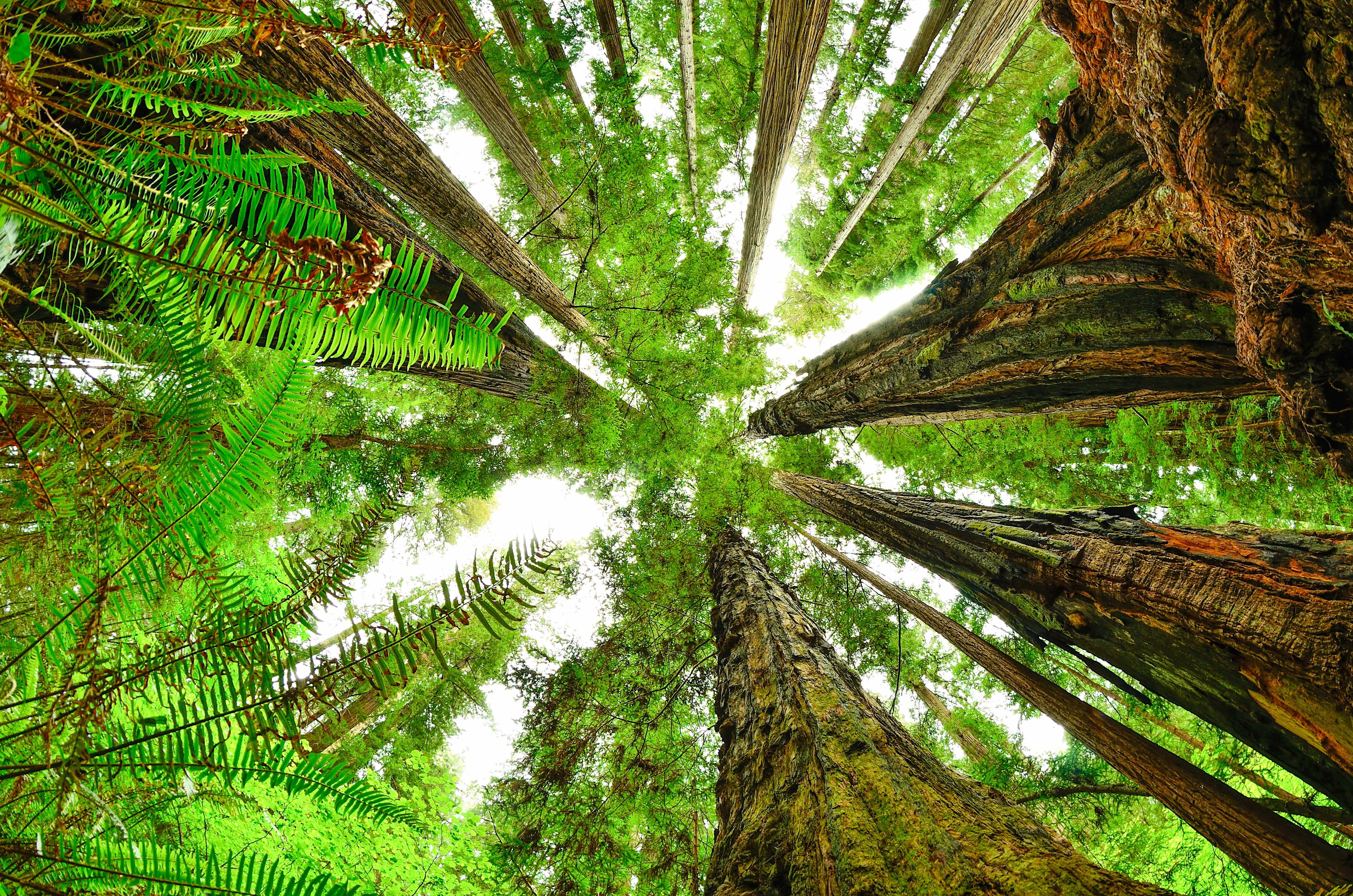
View from forest floor looking straight up. Ferns as seen close up and redwood trunks meet.
Fish-eye view of Redwood canopyNPS Photo / Steve Olson
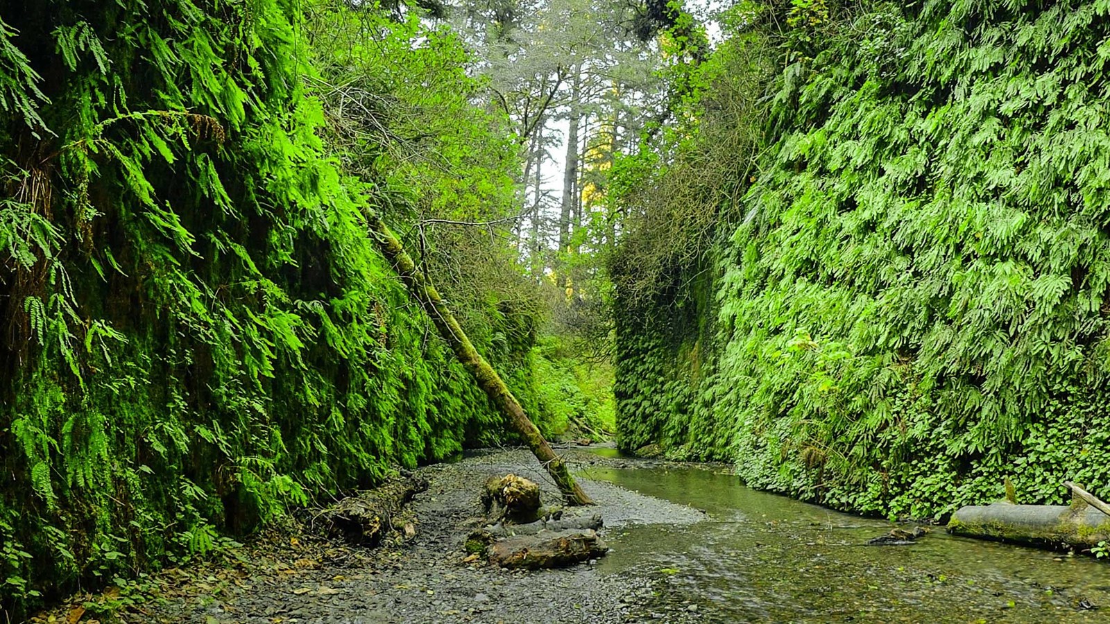
Fern-covered canyon walls above a shallow creek and cobbled streambed.
Fern CanyonNPS / Steve Olson

Check before you go

Redwood month by month

Open a monthly guide, then compare the park-wide visit pattern and the climate normals from the coastal station at Klamath below.

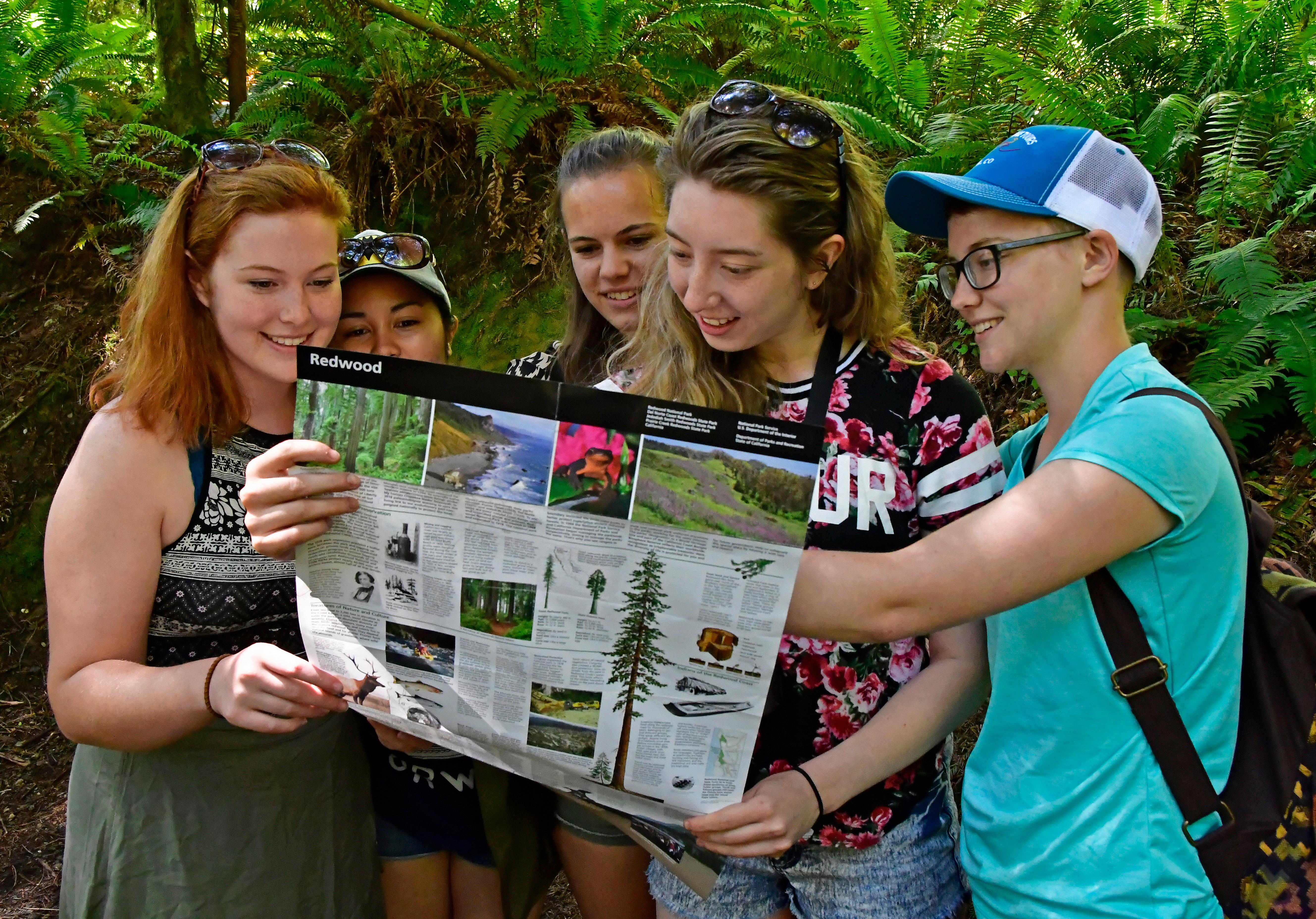
Five young women read the park map.
Visitors Plan Their Redwood TripNPS: John Chao

Best time to visit Redwood National and State Parks

May through September

September is our pick because coastal temperatures are still mild and average national-park visits are 24% less than the peak in June. These counts do not measure all state-park traffic.

Get to know the redwood parks

Redwood National Park and three California state parks are managed together along about 50 miles of coast. Most sights sit along U.S. 101 and its side roads, with no entrance stations.

Redwood road approaches There is no single gate for Redwood National and State Parks. US 101 connects the main areas, with separate roads to groves and the coast. Visitor-center markers locate access areas rather than toll gates. Lettered points are the reviewed entrance or access-area locations. They do not mark every road, trail or gate. Hiouchi Visitor CenterD Jedediah Smith Visitor CenterE Crescent City Information CenterC Prairie Creek Visitor CenterB Thomas H. Kuchel Visitor CenterAThomas H. Kuchel VisitorCenterPrairie Creek Visitor CenterCrescent CityInformation CenterHiouchi Visitor CenterN
  • A Thomas H. Kuchel Visitor Center
  • B Prairie Creek Visitor Center
  • C Crescent City Information Center
  • D Hiouchi Visitor Center
  • E Jedediah Smith Visitor Center
  • Park boundary
People stand next to redwood tree and a viewing deck. Orientation signs in the foreground.
Big Tree WaysideNPS Photo / G Litten

Prairie Creek and the parkway

The 10-mile Newton B. Drury Scenic Parkway winds through old-growth redwoods past Big Tree Wayside, the Prairie Creek Visitor Center and meadows where elk often graze.

The parkway is paved, and commercial vehicles are not permitted. Give elk at least 25 yards, and more in spring and fall.

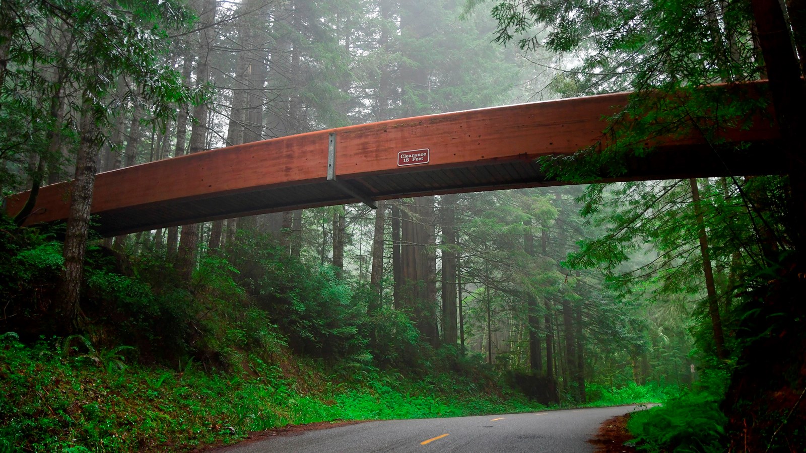
A brown wooden bridge crosses a road. Trees crowd the scene
Lady Bird Johnson Grove trailhead bridgeNPS / John Chao

Bald Hills Road

A steep road climbing from near Orick to Lady Bird Johnson Grove, the Tall Trees Grove trailhead, Redwood Creek Overlook and open prairies with spring wildflowers.

Mostly unpaved higher up; RVs and trailers are not advised. Tall Trees Trailhead needs a permit all year. The photo shows the bridge at the Lady Bird Johnson Grove trailhead.

Jedediah Smith Redwoods

In the north near Hiouchi, where Howland Hill Road runs 10 miles through old growth to trailheads including Stout Grove.

Howland Hill Road is mostly unpaved, and motorhomes, RVs and trailers will not fit on it.

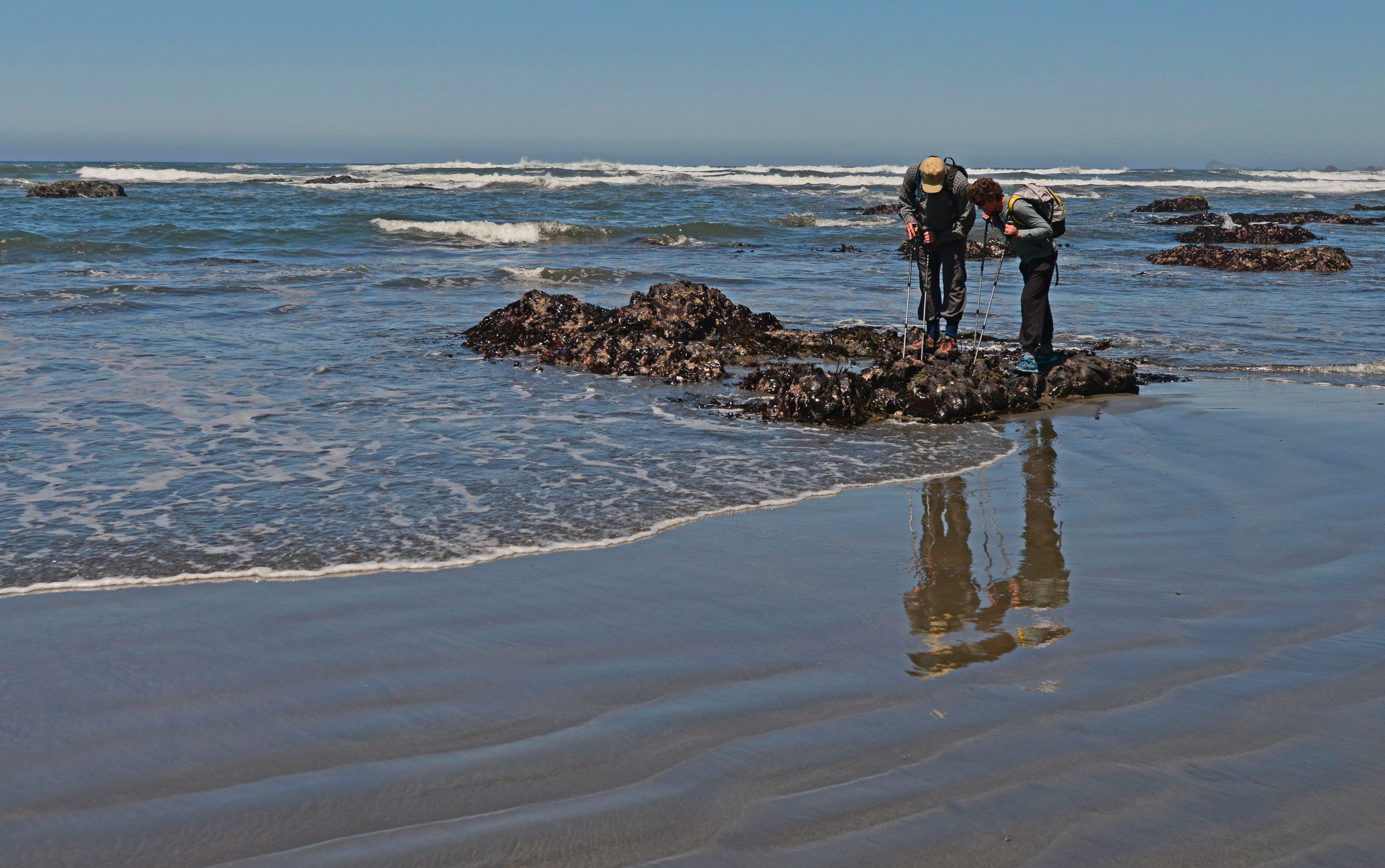
Two visitors looking at tidepools.
Tide pooling at Enderts BeachNPS Photo / John Chao

North coast near Crescent City

Crescent Beach, the Crescent Beach Overlook and the Enderts Beach trailhead lie just south of Crescent City, with spots for whale watching and tidepools.

Sneaker waves and tides make these beaches dangerous. RVs are not advised past the Crescent Beach picnic area.

Redwood crowds by month

These are five-year monthly averages of NPS recreation visits. They compare seasonal demand, not unique visitors, trailhead parking or reservation availability.

LowestLowModerateHighPeakAverage month: 52,146

Redwood weather by month

Compare typical daily highs, lows and monthly precipitation at the coast. Inland areas are warmer and sunnier in summer.

Cooler Hotter
Jan
High55°F
Low39°F
Precip · in13.38
Feb
High56°F
Low39°F
Precip · in10.67
Mar
High57°F
Low40°F
Precip · in10.65
Apr
High59°F
Low43°F
Precip · in6.64
May
High61°F
Low47°F
Precip · in3.59
Jun
High64°F
Low47°F
Precip · in1.78
Jul
High66°F
Low53°F
Precip · in0.26
Aug
High66°F
Low51°F
Precip · in0.33
Sep
High67°F
Low50°F
Precip · in1.26
Oct
High63°F
Low45°F
Precip · in4.99
Nov
High58°F
Low41°F
Precip · in10.09
Dec
High54°F
Low38°F
Precip · in15.25

These normals come from Klamath, at about 28 feet near the mouth of the Klamath River, so they describe the foggy coastal lowland. Inland areas are warmer and sunnier, and the Bald Hills get much hotter in summer.

What each season brings

The coast stays mild all year. Rain, fog, elk seasons and summer reservations change the trip more than temperature does.

Spring

Storms ease after April. Elk calving runs from late May through June, when cows can charge to protect hidden calves.

Spring wildflowers in the Bald Hills

As Bald Hills Road climbs, it opens onto rolling prairies full of spring wildflowers, where elk and black bears are often seen.

The road is steep and mostly unpaved higher up. Inland prairies get much warmer than the coast.

Summer

Fog often wraps the coast while inland areas stay warmer and sunnier. Fern Canyon parking needs a reservation, and Mill Creek Campground opens.

Fall

Storms return from October. The elk rut runs from late August through October, so give bulls extra room.

Elk rut

From late August through October, bull elk gather cows into groups and may stomp and charge at people and vehicles.

Watch from a distance. If a bull is near the trail, back away slowly and find another route.

Winter

Cool and wet: most of the region's 60 to 80 inches of yearly rain falls from October through April. Cal-Barrel Road closes to vehicles in winter.

Example Redwood itineraries

Spend one day in the south and one in the north. A third day fits Tall Trees Grove.

How many full days do you have?

Count full days in the parks. Sights spread along about 50 miles of coast, so group each day by area.

One day: Prairie Creek and the southern groves

  1. People stand next to redwood tree and a viewing deck. Orientation signs in the foreground.
    Big Tree WaysideNPS Photo / G Litten
    Day 1

    Prairie Creek and the southern groves

    Old-growth giants, elk meadows and a short grove walk.

    • First stop. Start at the Kuchel Visitor Center south of Orick, which NPS calls the best starting point for first-time visitors.
    • Parkway. Drive the 10-mile scenic parkway through Prairie Creek, past Big Tree Wayside and elk meadows.
    • Grove walk. Walk Lady Bird Johnson Grove, reached by Bald Hills Road just north of Orick.

    Fern Canyon: From May 15 to September 15, parking at Fern Canyon and Gold Bluffs Beach needs a day-use reservation made by the day before.

Two days: south, then north

  1. People stand next to redwood tree and a viewing deck. Orientation signs in the foreground.
    Big Tree WaysideNPS Photo / G Litten
    Day 1

    Prairie Creek and the southern groves

    Old-growth giants, elk meadows and a short grove walk.

    • First stop. Start at the Kuchel Visitor Center south of Orick, which NPS calls the best starting point for first-time visitors.
    • Parkway. Drive the 10-mile scenic parkway through Prairie Creek, past Big Tree Wayside and elk meadows.
    • Grove walk. Walk Lady Bird Johnson Grove, reached by Bald Hills Road just north of Orick.

    Fern Canyon: From May 15 to September 15, parking at Fern Canyon and Gold Bluffs Beach needs a day-use reservation made by the day before.

  2. Two visitors looking at tidepools.
    Tide pooling at Enderts BeachNPS Photo / John Chao
    Day 2

    Jedediah Smith and the north coast

    A gravel road through old growth, then tidepools and ocean views.

    • Howland Hill Road. Drive this mostly unpaved 10-mile road through old-growth redwoods; motorhomes and trailers will not fit.
    • Stout Grove. Stop at Stout Grove, one of the trailheads along the road.
    • Coast. Finish at Crescent Beach Overlook or the Enderts Beach trailhead, a short drive south of Crescent City.

    At the beach: Never turn your back on the ocean. Sneaker waves have drowned visitors here, and tides can cut off your way back.

Three days: add Tall Trees Grove

  1. People stand next to redwood tree and a viewing deck. Orientation signs in the foreground.
    Big Tree WaysideNPS Photo / G Litten
    Day 1

    Prairie Creek and the southern groves

    Old-growth giants, elk meadows and a short grove walk.

    • First stop. Start at the Kuchel Visitor Center south of Orick, which NPS calls the best starting point for first-time visitors.
    • Parkway. Drive the 10-mile scenic parkway through Prairie Creek, past Big Tree Wayside and elk meadows.
    • Grove walk. Walk Lady Bird Johnson Grove, reached by Bald Hills Road just north of Orick.

    Fern Canyon: From May 15 to September 15, parking at Fern Canyon and Gold Bluffs Beach needs a day-use reservation made by the day before.

  2. Two visitors looking at tidepools.
    Tide pooling at Enderts BeachNPS Photo / John Chao
    Day 2

    Jedediah Smith and the north coast

    A gravel road through old growth, then tidepools and ocean views.

    • Howland Hill Road. Drive this mostly unpaved 10-mile road through old-growth redwoods; motorhomes and trailers will not fit.
    • Stout Grove. Stop at Stout Grove, one of the trailheads along the road.
    • Coast. Finish at Crescent Beach Overlook or the Enderts Beach trailhead, a short drive south of Crescent City.

    At the beach: Never turn your back on the ocean. Sneaker waves have drowned visitors here, and tides can cut off your way back.

  3. Day 3

    Tall Trees Grove

    A permit hike into a remote grove of giants.

    • Permit first. Reserve a Tall Trees Trailhead permit online; the gate code arrives by email.
    • Plan the time. Allow at least four hours, including a 1-hour drive partly on dirt road and the 4.5-mile round-trip hike.
    • Save energy. The trail drops 800 feet in the first 1.5 miles, so the hard part is the climb back.

    No permit? Many trails show big trees without a reservation, including Lady Bird Johnson Grove.

Getting there and around

Plan on a car. The parks have no entrance stations, and most sights are reached from U.S. 101.

AreaBy carWithout a car
Exit U.S. 101 about 6 miles north of Orick or 4 miles south of Klamath onto the parkway.NPS lists no park shuttle. Plan on a car; sights are spread along about 50 miles of coast.
Davison Road leaves U.S. 101 north of Orick. Expect gravel and two stream crossings; RVs over 24 feet and trailers are not permitted.NPS lists no park shuttle. Plan on a car; sights are spread along about 50 miles of coast.
Bald Hills Road leaves U.S. 101 about a mile north of Orick and climbs a steep 15% grade.NPS lists no park shuttle. Plan on a car; sights are spread along about 50 miles of coast.
U.S. 199 east of Crescent City to Hiouchi, or Howland Hill Road from Crescent City for cars only.NPS lists no park shuttle. Plan on a car; sights are spread along about 50 miles of coast.
Enderts Beach Road leaves U.S. 101 about 2.5 miles southeast of Crescent City.NPS lists no park shuttle. Plan on a car; sights are spread along about 50 miles of coast.

Choose where to stay

Camping is the only way to stay overnight in the parks. Pick the end of the parks you want to explore, then camp there or stay in a town on U.S. 101.

Inside or outside?

In the park

Four developed campgrounds and eight basic cabins keep you close to the groves. Book early; the cabins are often reserved months ahead.

Outside the park

There are no hotels or lodges in the parks. Nearby communities along U.S. 101 have rooms and more camping.

Where you'll spend most daysStay in the parkStay outside, on the same road

South: Prairie Creek and Fern Canyon

Good for the parkway, elk and Fern Canyon.

Normal season: Camping all year

Prairie Creek (Elk Prairie) Campground, with four cabins, and Gold Bluffs Beach Campground are open all year.

Campers there do not need a separate Fern Canyon reservation.

Orick, on U.S. 101 at the southern end of the parks.

North: Jedediah Smith and Crescent City

Good for Stout Grove, Howland Hill Road and the north coast.

Normal season: Camping all year

Jedediah Smith Campground, with four cabins, is open all year.

Mill Creek Campground opens in summer.

Crescent City, home of the park headquarters, at the northern end of the parks.

Seasons are the normal pattern, not this year's openings. Confirm dates and reservations with the campground.

Planning your Redwood visit

Answers to the first decisions, with the official sources for details.

Do you need a reservation to visit Redwood National and State Parks?

No reservation is needed to enter, and there are no entrance stations. Fern Canyon and Gold Bluffs Beach parking needs a day-use reservation from May 15 to September 15, and Tall Trees Trailhead needs one all year. NPS frequently asked questions NPS Gold Bluffs Beach and Fern Canyon reservations NPS Tall Trees Trailhead reservations

Is there a fee to visit?

The parks are fee free, except for day-use areas in Prairie Creek, Del Norte Coast and Jedediah Smith Redwoods State Parks. Fern Canyon is in a fee area. NPS basic information

Is there a drive-through tree in Redwood National Park?

No. There are no drive-through trees in the parks. Three privately owned drive-through redwoods elsewhere in California charge a fee. NPS frequently asked questions

Where can I see Roosevelt elk?

Herds often gather around Prairie Creek, Elk Meadow on Davison Road, Gold Bluffs Beach, Crescent Beach and the Bald Hills. Stay at least 25 yards away, and farther in spring and fall. NPS Roosevelt elk

Where is Redwood National and State Parks?

Along about 50 miles of the northern California coast, from Crescent City near the Oregon border to south of Orick. The parks' headquarters is in Crescent City. NPS directions NPS frequently asked questions

How we built this page.

An independent guide using official data. Not affiliated with or endorsed by the National Park Service.

Crowds
2021–2025 monthly averages. NPS recreation visits, compared with the park’s own busiest month. Visits are not unique visitors or a count of people on a trail.
Weather
1991-2020 climate normals. NOAA’s Klamath, CA station. These describe typical weather at the station, not every part of the park or a forecast.
Roads & lodging
Normal seasonal schedules. NPS guidance and official operator information. Confirm access, hours and availability before you travel.