Redwood National and State Parks in April

Redwood National and State Parks in April can suit grove walks and a conditional coastal outing. Spring rain still affects footing and approach roads.
National Sites Guide

Share this page

Cite this page

Copy a citation

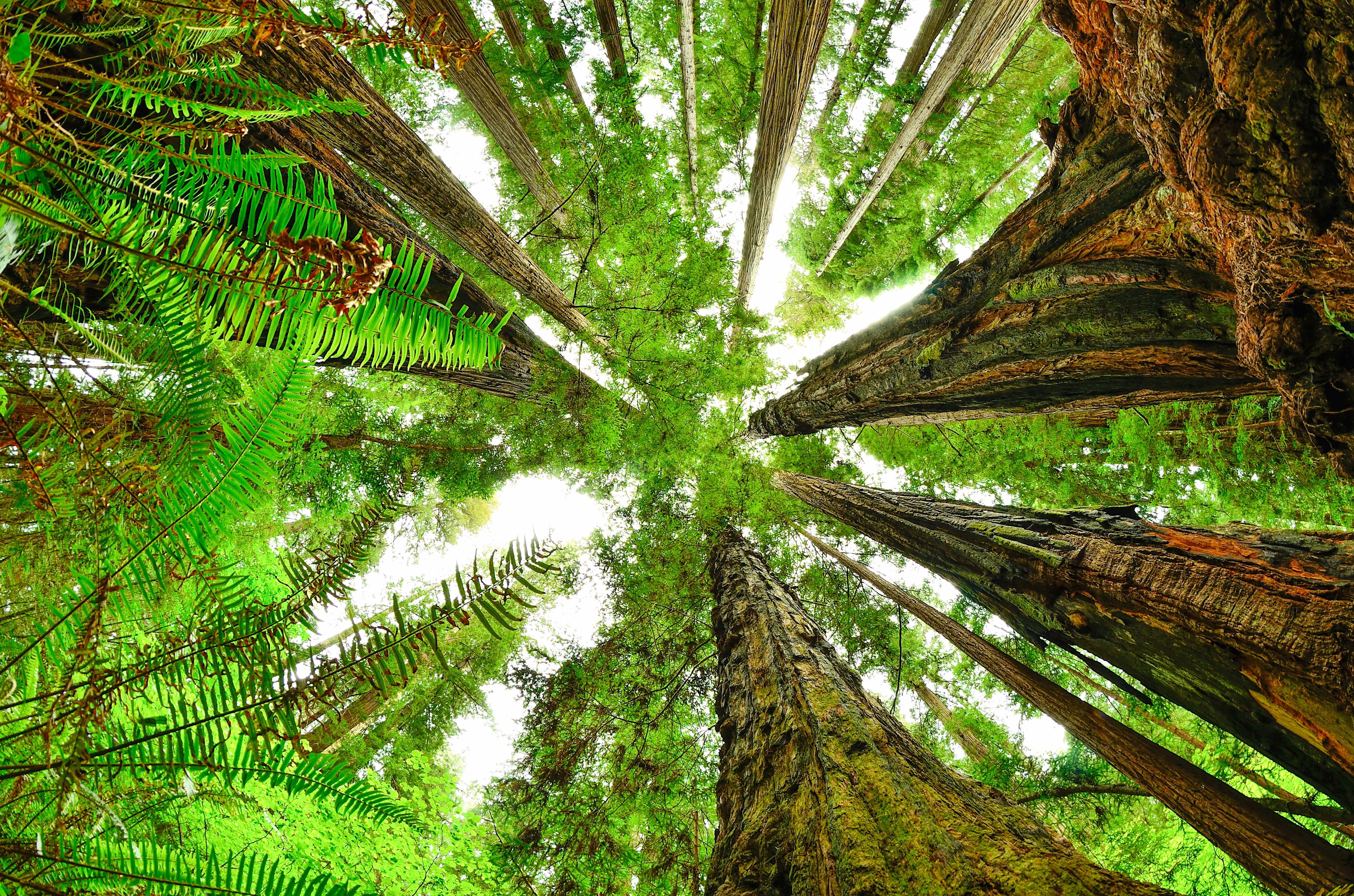
View from forest floor looking straight up. Ferns as seen close up and redwood trunks meet.
Fish-eye view of Redwood canopyNPS Photo / Steve Olson
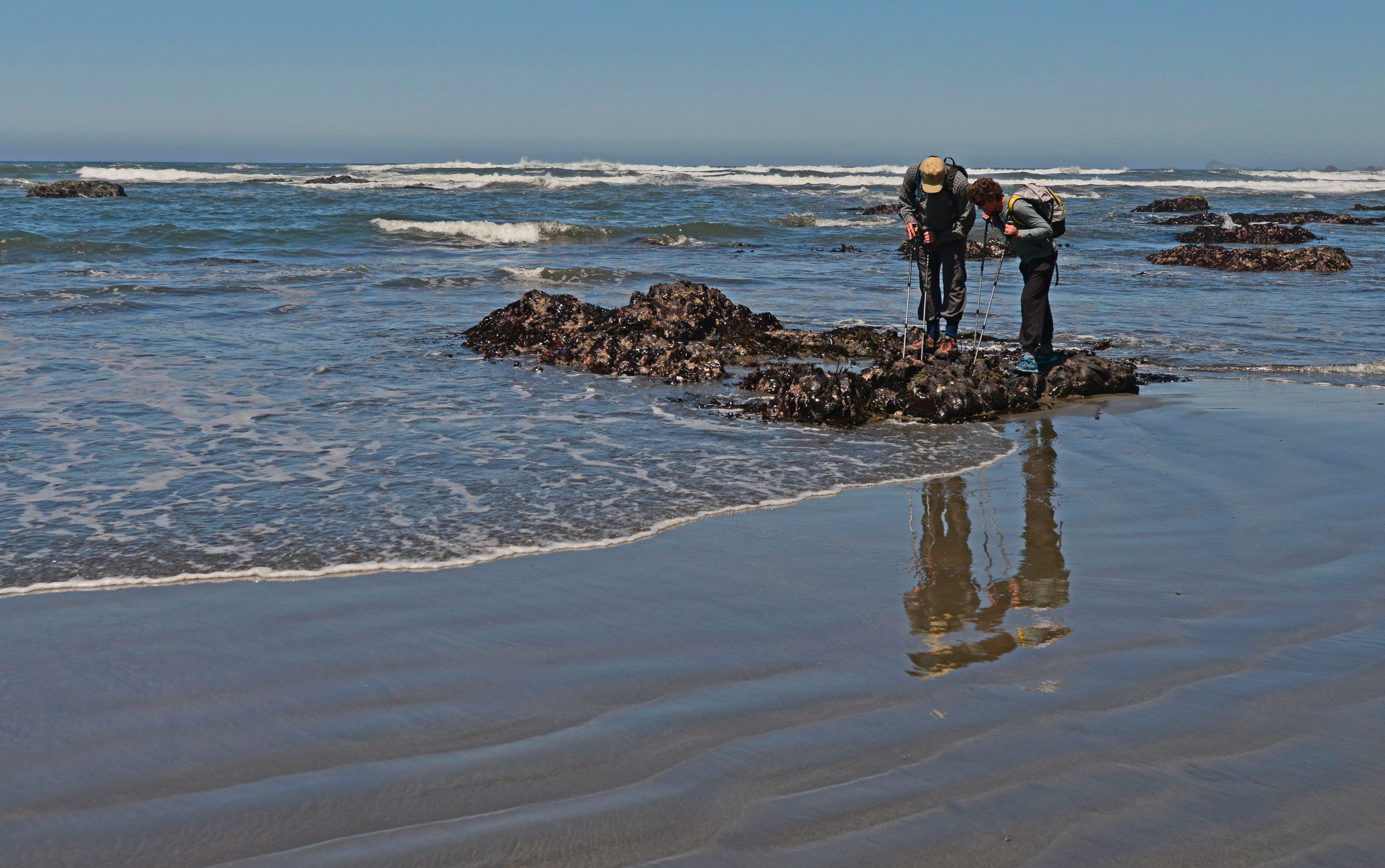
Two visitors looking at tidepools.
Tide pooling at Enderts BeachNPS Photo / John Chao

Conditions

Last checked:

Check before you go

What to see and do in Redwood in April

Choose an April outing that fits the route, weather and effort involved.

Redwood weather in April

April’s normal high is 59°F and low is 43°F, with 6.64 inches of precipitation. The Klamath station sits at about 28 ft near the Klamath River mouth, near the middle of the parks' 50 miles of coast, so it stands in for the coastal lowland along U.S. 101. NPS says summer brings cool coastal temperatures with frequent fog, while inland areas are typically warmer with clearer skies, and the Bald Hills get much hotter in summer than the coast. The station's snowfall normals are zero.

Cooler Hotter
Jan
High55°F
Low39°F
Precip · in13.38
Feb
High56°F
Low39°F
Precip · in10.67
Mar
High57°F
Low40°F
Precip · in10.65
April
High59°F
Low43°F
Precip · in6.64
May
High61°F
Low47°F
Precip · in3.59
Jun
High64°F
Low47°F
Precip · in1.78
Jul
High66°F
Low53°F
Precip · in0.26
Aug
High66°F
Low51°F
Precip · in0.33
Sep
High67°F
Low50°F
Precip · in1.26
Oct
High63°F
Low45°F
Precip · in4.99
Nov
High58°F
Low41°F
Precip · in10.09
Dec
High54°F
Low38°F
Precip · in15.25

Redwood crowds in April

April averages 40,599 recreation visits, 43% of the peak monthly average in June.

LowestLowModerateHighPeakAverage month: 52,146April

Tips for your April visit

Check the approach before choosing the rest of the day.

Redwood road approaches There is no single gate for Redwood National and State Parks. US 101 connects the main areas, with separate roads to groves and the coast. Visitor-center markers locate access areas rather than toll gates. Lettered points are the reviewed entrance or access-area locations. They do not mark every road, trail or gate. Hiouchi Visitor CenterD Jedediah Smith Visitor CenterE Crescent City Information CenterC Prairie Creek Visitor CenterB Thomas H. Kuchel Visitor CenterAN
AThomas H. Kuchel Visitor CenterBPrairie Creek Visitor CenterCCrescent City Information CenterDHiouchi Visitor CenterEJedediah Smith Visitor Center
  • Park boundary

How we built this page.

An independent guide using official data. Not affiliated with or endorsed by the National Park Service.

Crowds
2021–2025 monthly averages. NPS recreation visits, compared with the park’s own busiest month. Visits are not unique visitors or a count of people on a trail.
Weather
1991-2020 climate normals. NOAA’s Klamath, CA station. These describe typical weather at the station, not every part of the park or a forecast.
Roads & lodging
Normal seasonal schedules. NPS guidance and official operator information. Confirm access, hours and availability before you travel.