Rocky Mountain National Park

For a first visit to Rocky Mountain National Park in northern Colorado, start with the Bear Lake Road corridor near Estes Park. Then cross Trail Ridge Road above 12,000 feet when it is open, normally late May to mid-October. There are no lodges in the park, so base yourself in Estes Park or Grand Lake.

National Sites Guide

Share this page

Cite this page

Copy a citation

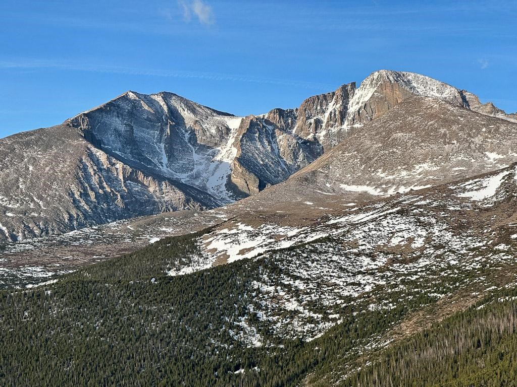
Snow dusts the surface of Longs Peak and Mount Meeker
Longs Peak and Mount MeekerNPS/D.Turk
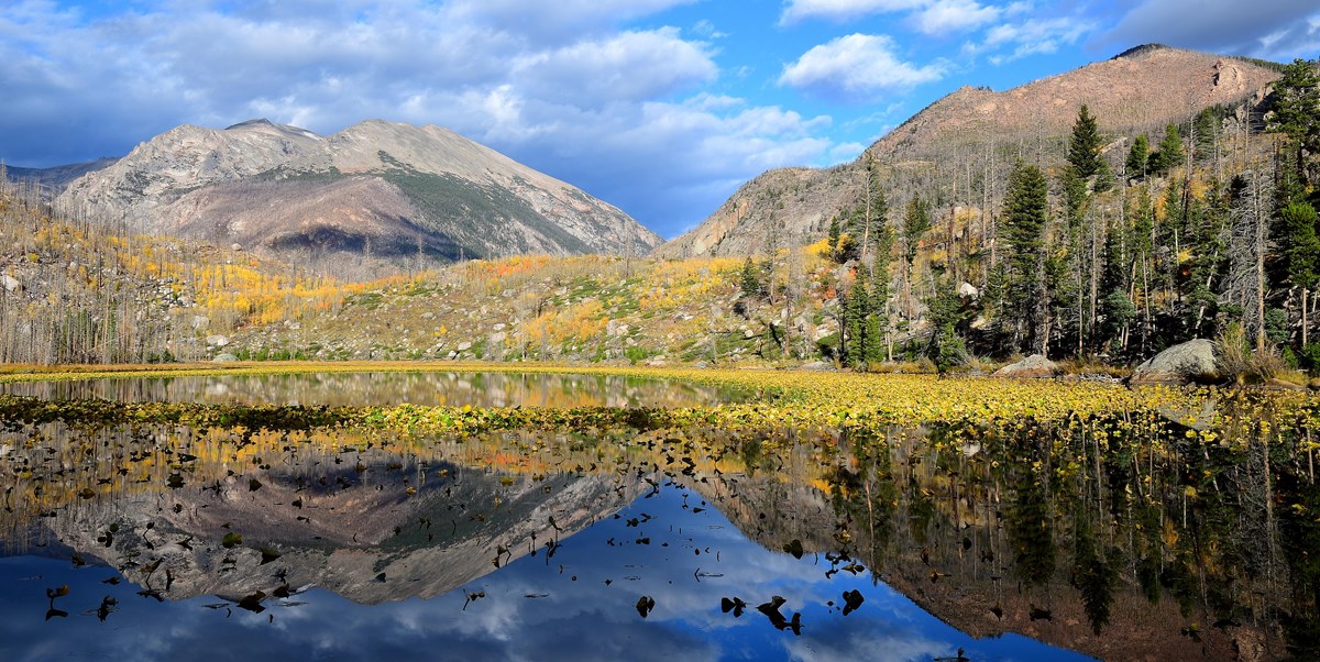
Cub Lake with reflections. Yellow and brown grasses line the edge of the lake.
Cub Lake in fallNPS/J.Marino
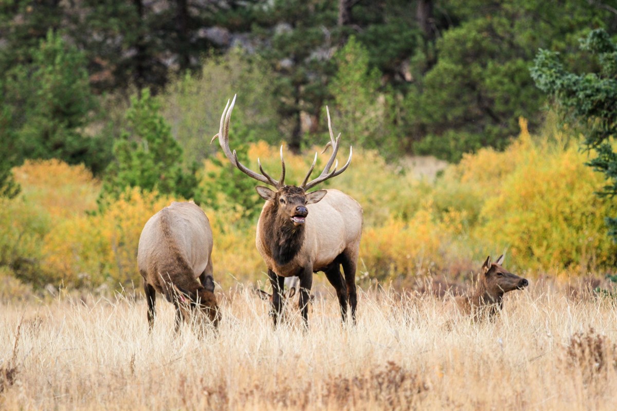
a bull elk is standing next to two cow elk in a meadow. Aspen have yellow and green leaves
Elk in fallNPS/P.Baker

Check before you go

Rocky Mountain month by month

Open a monthly guide, then compare park-wide visits and Estes Park precipitation normals below.

a bull elk is standing next to two cow elk in a meadow. Aspen have yellow and green leaves
Elk in fallNPS/P.Baker

Best time to visit Rocky Mountain

June through September

September is our pick because the normal seasonal trip remains practical and average visits are 25% less than the peak in July. September brings cold nights, possible early snow and campground closures. July or August is the alternative for the broadest camping choice.
Get to know Rocky Mountain's main areas

Rocky Mountain is in northern Colorado, about 75 miles northwest of Denver. Two east entrances sit near Estes Park and one west entrance near Grand Lake. Trail Ridge Road links the two sides in summer.

Rocky Mountain approaches Reviewed approach locations. Markers locate approaches, not every trailhead or a guarantee of a through-route. Fall River EntranceB Beaver Meadows EntranceA Grand Lake EntranceCBeaver MeadowsEntranceFall River EntranceGrand Lake EntranceN
  • A Beaver Meadows Entrance
  • B Fall River Entrance
  • C Grand Lake Entrance
  • Park boundary
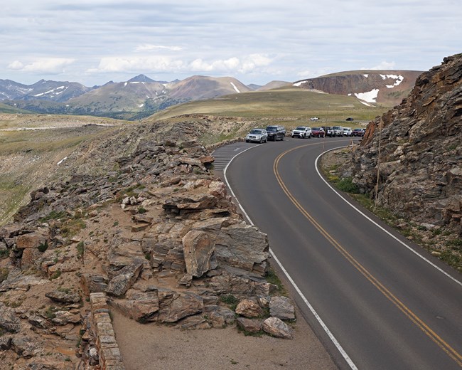
Trail Ridge Road from Rock Cut
Trail Ridge RoadNPS

Trail Ridge Road and the alpine tundra

This seasonal road connects the east and west sides and crosses over 12,000 feet. Rangers staff the Alpine Visitor Center in season.

On the map: the road is not drawn; it runs between the Fall River and Grand Lake entrance markers. It is normally closed to through travel from mid-October to late May.

Rocky Mountain crowds by month

These are five-year monthly averages of park-wide NPS recreation visits. They compare seasonal demand, not unique visitors, entrance lines or trailhead parking.

LowestLowModerateHighPeakAverage month: 352,948

Rocky Mountain weather by month

Compare total monthly precipitation at Estes Park. NOAA publishes no temperature normals for this station, so highs and lows are not shown.

Jan
HighN/A
LowN/A
Precip · in0.46
Feb
HighN/A
LowN/A
Precip · in0.80
Mar
HighN/A
LowN/A
Precip · in0.97
Apr
HighN/A
LowN/A
Precip · in2.03
May
HighN/A
LowN/A
Precip · in2.49
Jun
HighN/A
LowN/A
Precip · in1.51
Jul
HighN/A
LowN/A
Precip · in1.84
Aug
HighN/A
LowN/A
Precip · in1.82
Sep
HighN/A
LowN/A
Precip · in1.73
Oct
HighN/A
LowN/A
Precip · in0.84
Nov
HighN/A
LowN/A
Precip · in0.76
Dec
HighN/A
LowN/A
Precip · in0.36

These normals come from the Estes Park station, an east-side gateway at about 7,522 feet, not an in-park station. NOAA leaves its temperature and snowfall normals blank, so only precipitation is shown. The park rises above 14,000 feet, where conditions differ sharply.

What's at its best and when

Elevation sets the calendar. Trail Ridge Road, the alpine tundra and the elk rut follow different seasons from the lower meadows.

Spring

March and April are historically among the snowiest months in these mountains. Expect snow-packed trails into early June and pack traction devices.

Summer

Trail Ridge Road from Rock Cut
Trail Ridge RoadNPS

The summer season spans late May to September. Trail Ridge Road and Old Fall River Road lead up to the alpine tundra.

Alpine tundra above 12,000 feet

Summer is when Trail Ridge Road opens a drive across the alpine tundra, one of the park's three life zones.

The air is thin and weather turns quickly at this elevation. The photo shows the road from Rock Cut, not a wildflower date.

Fall

a bull elk is standing next to two cow elk in a meadow. Aspen have yellow and green leaves
Elk in fallNPS/P.Baker

Aspens turn gold, orange and red, and elk bugle in the meadows. Frost and snow begin to dust the peaks along the Continental Divide.

Elk rut in the meadows

Elk can be seen any time, but the fall rut is a popular viewing period. Their bugles carry across meadows at dawn and dusk.

Some meadows close to off-trail travel each evening and morning during the rut. To check your distance, make a thumbs-up, extend your arm all the way and close one eye. If you can still see the animal past your thumb, step back until it is completely hidden. Keep at least 75 feet from elk, and back away if one approaches you or changes its behavior.

Winter

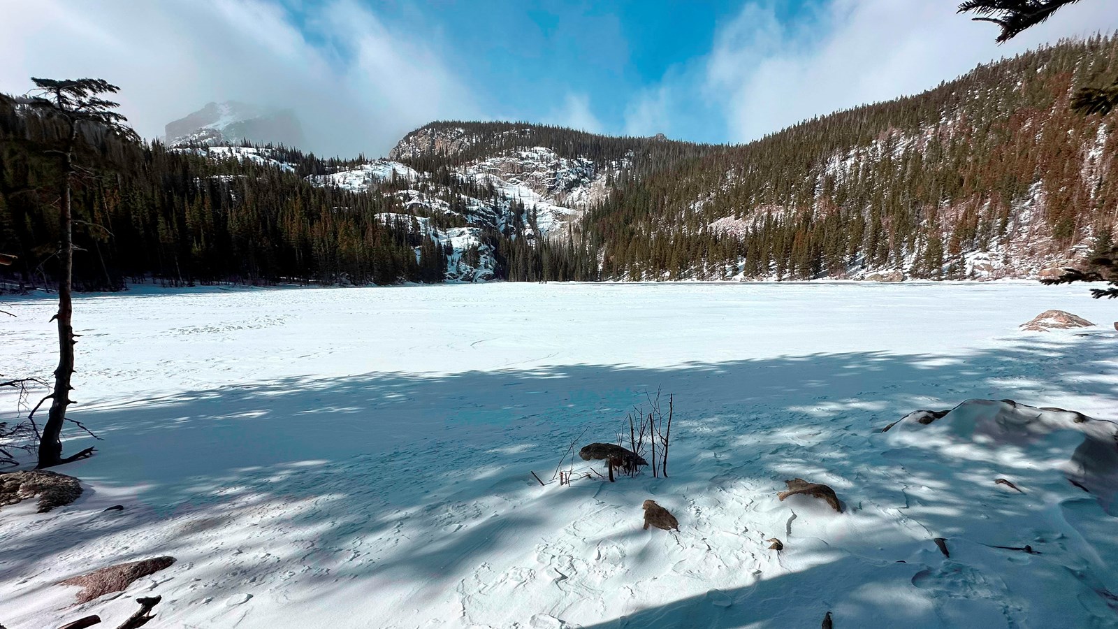
Bear Lake, the surface of the lake is frozen and covered with snow on a sunny day
Bear Lake in winterNPS Photo / D. Turk

Trail Ridge Road is closed to through travel. Moraine Park is the only campground open in winter, with first-come, first-served sites.

Snowshoe to frozen lakes

From October to early June, most trails are snow-packed. Traction devices are advised and you may need snowshoes.

The photo shows Bear Lake frozen in winter. Conditions change quickly, so prepare your vehicle for winter driving.

Example Rocky Mountain Itineraries

Start near Estes Park, then go up and over.

How many full days do you have?

Count full days in the park, not nights booked. The park climbs from about 7,800 feet to over 14,000 feet, so take the first day gently.

One day: the Bear Lake Road corridor

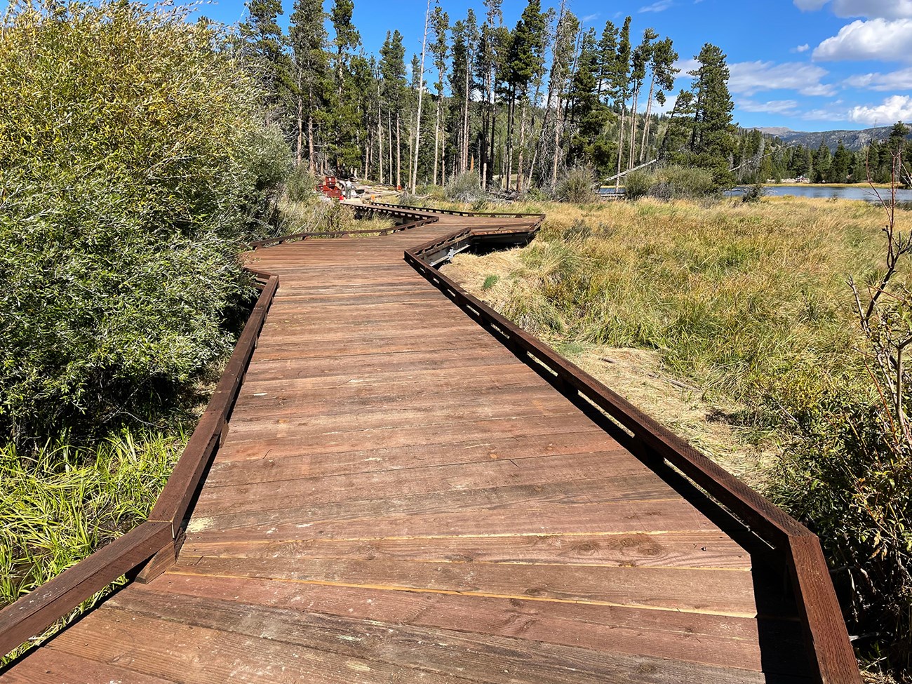
  1. A broad boardwalk with low wooden edges crosses wet ground beside Sprague Lake.
    Sprague Lake boardwalkNPS
    Day 1

    Bear Lake Road corridor

    Lakes, meadows and trails on one of the park's busiest roads.

    • Park once. In summer and early fall, ride the free shuttle from Park & Ride to Bear Lake and other stops.
    • Bear Lake. The road climbs to 9,475 feet at the Bear Lake trailhead.
    • Sprague Lake or Moraine Park. Add an easy lake walk or a meadow stop on the way back down.

    Entry: Timed entry reservations can apply in the busy season, so check the rules for your dates.

Two days: add Trail Ridge Road

  1. A broad boardwalk with low wooden edges crosses wet ground beside Sprague Lake.
    Sprague Lake boardwalkNPS
    Day 1

    Bear Lake Road corridor

    Lakes, meadows and trails on one of the park's busiest roads.

    • Park once. In summer and early fall, ride the free shuttle from Park & Ride to Bear Lake and other stops.
    • Bear Lake. The road climbs to 9,475 feet at the Bear Lake trailhead.
    • Sprague Lake or Moraine Park. Add an easy lake walk or a meadow stop on the way back down.

    Entry: Timed entry reservations can apply in the busy season, so check the rules for your dates.

  2. Trail Ridge Road from Rock Cut
    Trail Ridge RoadNPS
    Day 2

    Trail Ridge Road

    Cross the alpine tundra above 12,000 feet.

    • Drive up. Trail Ridge Road connects the east and west sides and crosses over 12,000 feet.
    • Alpine Visitor Center. Rangers staff it in season, so stop for questions and a look at the tundra.
    • Pack layers. Even in summer, temperatures can drop at high elevations, so bring warm and rain layers.

    If Trail Ridge Road is unavailable: From mid-October to late May it is normally closed to through travel. Stay on the east side, or drive around the park to reach Grand Lake.

Three days: add the Kawuneeche Valley

  1. A broad boardwalk with low wooden edges crosses wet ground beside Sprague Lake.
    Sprague Lake boardwalkNPS
    Day 1

    Bear Lake Road corridor

    Lakes, meadows and trails on one of the park's busiest roads.

    • Park once. In summer and early fall, ride the free shuttle from Park & Ride to Bear Lake and other stops.
    • Bear Lake. The road climbs to 9,475 feet at the Bear Lake trailhead.
    • Sprague Lake or Moraine Park. Add an easy lake walk or a meadow stop on the way back down.

    Entry: Timed entry reservations can apply in the busy season, so check the rules for your dates.

  2. Trail Ridge Road from Rock Cut
    Trail Ridge RoadNPS
    Day 2

    Trail Ridge Road

    Cross the alpine tundra above 12,000 feet.

    • Drive up. Trail Ridge Road connects the east and west sides and crosses over 12,000 feet.
    • Alpine Visitor Center. Rangers staff it in season, so stop for questions and a look at the tundra.
    • Pack layers. Even in summer, temperatures can drop at high elevations, so bring warm and rain layers.

    If Trail Ridge Road is unavailable: From mid-October to late May it is normally closed to through travel. Stay on the east side, or drive around the park to reach Grand Lake.

  3. Historic cabins beside trees and a path at Holzwarth Historic Site.
    Cabins at Holzwarth Historic SiteNPS
    Day 3

    Kawuneeche Valley

    The quieter west side, with river walks and a historic ranch.

    • Coyote Valley. Look for wildlife in the open valley.
    • Holzwarth Historic Site. Walk a half mile from the parking area to most of the historic cabins.
    • Colorado River Trail. Take a hike along the young Colorado River.

    Getting there: Without Trail Ridge Road, you reach Grand Lake by routes outside the park.

Four or more days: add the meadows

  1. A broad boardwalk with low wooden edges crosses wet ground beside Sprague Lake.
    Sprague Lake boardwalkNPS
    Day 1

    Bear Lake Road corridor

    Lakes, meadows and trails on one of the park's busiest roads.

    • Park once. In summer and early fall, ride the free shuttle from Park & Ride to Bear Lake and other stops.
    • Bear Lake. The road climbs to 9,475 feet at the Bear Lake trailhead.
    • Sprague Lake or Moraine Park. Add an easy lake walk or a meadow stop on the way back down.

    Entry: Timed entry reservations can apply in the busy season, so check the rules for your dates.

  2. Trail Ridge Road from Rock Cut
    Trail Ridge RoadNPS
    Day 2

    Trail Ridge Road

    Cross the alpine tundra above 12,000 feet.

    • Drive up. Trail Ridge Road connects the east and west sides and crosses over 12,000 feet.
    • Alpine Visitor Center. Rangers staff it in season, so stop for questions and a look at the tundra.
    • Pack layers. Even in summer, temperatures can drop at high elevations, so bring warm and rain layers.

    If Trail Ridge Road is unavailable: From mid-October to late May it is normally closed to through travel. Stay on the east side, or drive around the park to reach Grand Lake.

  3. Historic cabins beside trees and a path at Holzwarth Historic Site.
    Cabins at Holzwarth Historic SiteNPS
    Day 3

    Kawuneeche Valley

    The quieter west side, with river walks and a historic ranch.

    • Coyote Valley. Look for wildlife in the open valley.
    • Holzwarth Historic Site. Walk a half mile from the parking area to most of the historic cabins.
    • Colorado River Trail. Take a hike along the young Colorado River.

    Getting there: Without Trail Ridge Road, you reach Grand Lake by routes outside the park.

  4. Bighorn sheep at Sheep Lakes in Horseshoe Park.
    Sheep LakesNPS Photo / Kim Grossman
    Day 4

    Meadows and wildlife

    Elk and bighorn sheep in the east-side meadows.

    • Moraine Park and Horseshoe Park. Look for elk in meadows and where meadow meets forest.
    • Keep your distance. Stay at least 75 feet from elk and bighorn sheep, and back away if an animal approaches or changes its behavior.
    • Dawn and dusk. In fall, the elk bugle carries across the meadows at the start and end of the day.

    In the fall rut: Some meadows close to off-trail foot travel from 5 p.m. to 10 a.m. to protect elk.

Getting there and around

Most visitors drive. In summer and early fall, park shuttles cover the Bear Lake Road corridor, and a Hiker Shuttle links Estes Park with the park.

AreaBy carWithout a car
Turn onto Bear Lake Road just inside the Beaver Meadows Entrance. Parking along the corridor is limited.In season, a reservable Hiker Shuttle runs from the Estes Park Visitor Center to Park & Ride. Free shuttles serve the corridor from there.
Only while Trail Ridge Road is open, normally late May to mid-October.No park shuttle crosses Trail Ridge Road; the in-park shuttles stay on the Bear Lake Road corridor.
Through the Grand Lake Entrance. In winter, drive around the park from the east side.Plan on a car. The park shuttles serve the east side only.

Choose where to stay

Pick the side of the park you'll spend most days on. Inside the park you can only camp; rooms are in the gateway towns.

Inside or outside?

In the park

Camping only: the park has no overnight lodging. Summer sites at the four main campgrounds need advance reservations.

Outside the park

Estes Park and Grand Lake have many lodging options, from hotels to campgrounds. Pick the town on the side you will explore most.

Where you'll spend most daysStay in the parkStay outside, on the same road

East side: Bear Lake and the meadows

Good for a first visit, short trips and shuttle users.

Normal season: Camping all year

Moraine Park, Glacier Basin and Aspenglen campgrounds.

Moraine Park stays open in winter with first-come, first-served sites.

Estes Park, beside the Beaver Meadows and Fall River entrances.

In season, the Hiker Shuttle runs from its visitor center into the park.

West side: Kawuneeche Valley

Good for the quieter west side and Trail Ridge Road from the west.

Normal season: Camping mostly summer

Timber Creek Campground, reserved in advance for summer.

Grand Lake, near the Grand Lake Entrance.

In winter, the drive from the east side goes around the park.

Seasons are the normal pattern, not this year's openings. Confirm dates with the campground or park before you book.

Planning your Rocky Mountain visit

Answers to the first decisions, with the official sources for details.

Where is Rocky Mountain National Park?

It is in northern Colorado, about 75 miles northwest of Denver. The Beaver Meadows and Fall River entrances are near Estes Park, and the Grand Lake Entrance is on the west side. NPS places to go

What should I see on a first visit to Rocky Mountain National Park?

Start with the Bear Lake Road corridor, then drive Trail Ridge Road when it is open. The Kawuneeche Valley suits a third day. NPS Bear Lake Road corridor NPS places to go

How many days do I need in Rocky Mountain National Park?

One day fits the Bear Lake corridor, two add Trail Ridge Road and three add the west side. These are our suggestions, not a minimum stay. NPS places to go

Can I stay inside Rocky Mountain National Park?

Only in a campground. NPS says the park has no overnight lodging; Estes Park and Grand Lake have hotels and other options. NPS eating and sleeping

When is Trail Ridge Road open?

It is a summer road. From mid-October to late May, weather and conditions permitting, it is closed to through travel, and drivers use routes outside the park to cross between sides. NPS places to go

How we built this page.

An independent guide using official data. Not affiliated with or endorsed by the National Park Service.

Crowds
2021–2025 monthly averages. NPS recreation visits, compared with the park’s own busiest month. Visits are not unique visitors or a count of people on a trail.
Weather
1991-2020 climate normals. NOAA’s Estes Park, CO station. These describe typical weather at the station, not every part of the park or a forecast.
Roads & lodging
Normal seasonal schedules. NPS guidance and official operator information. Confirm access, hours and availability before you travel.