East side · Estes Park
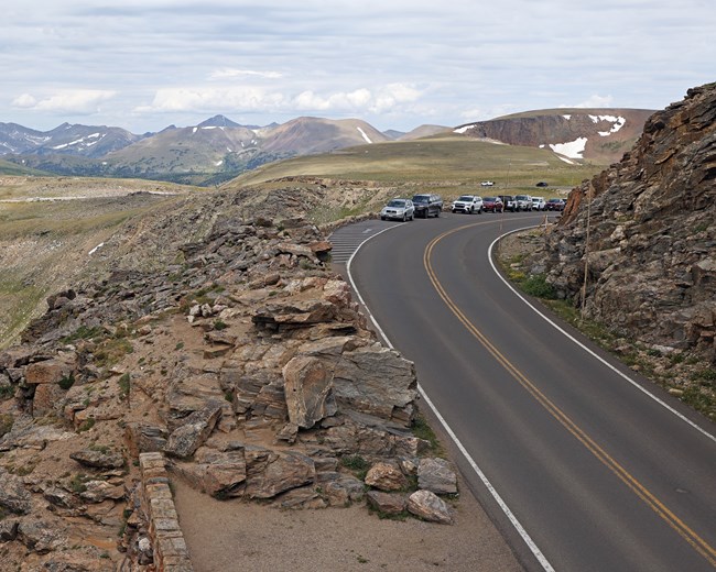
Bear Lake Road is a year-round route. Lower Trail Ridge Road serves Hidden Valley and the Many Parks Curve area when access permits.
For today’s Rocky Mountain National Park road closures, call the recorded status line at 970-586-1222. Trail Ridge Road and Old Fall River Road close to vehicles for winter; Bear Lake Road is a year-round route, subject to weather and traction restrictions. Compare normal road seasons below.
NPS alerts last checked
Alert list last changed
Straight from NPSRecorded Trail Ridge Road status970-586-1222
A road with no listed alert is not confirmed open.
Trail Ridge Road
Estes Park to Grand Lake crossing
Old Fall River Road
Endovalley to Alpine Visitor Center
Bear Lake Road
Bear Lake and Glacier Gorge
Trail Ridge Road · east
Lower approach from Estes Park
Trail Ridge Road · west
Lower approach from Grand Lake
Endovalley approach
Approach to Old Fall River Road
That read is behind our 15-minute schedule, so roads without an alert show Not checked.
We check NPS alerts every 15 minutes.
Call 970-586-1222 and read the official road guidance before leaving.
Read alerts for closures affecting your route, trailhead or parking.
Review Colorado highway conditions outside the park as well.
Trail Ridge Road connects Estes Park and Grand Lake. If it is closed, you cannot drive across the park. Bear Lake Road is a separate route on the Estes Park side.
Trail Ridge Road normally opens in late May; Old Fall River Road in early July. These are planning windows, not today’s road status.
| Road | Normal vehicle season | Destinations & limits |
|---|---|---|
Trail Ridge RoadEstes Park ↔ Grand Lake | Late May to mid-October2026 opening: May 29 | Alpine Visitor Center and the route between Estes Park and Grand Lake. Lower approaches have separate winter access. |
Old Fall River RoadEndovalley → Fall River Pass | Early July to early OctoberArchived 2026 opening: July 4 | One-way uphill, unpaved. No vehicles over 25 ft, trailers or towed vehicles. |
Bear Lake Road | Year-round route | Bear Lake, Sprague Lake and Glacier Gorge trailheads. 21 ft maximum west of Park & Ride. Weather and traction restrictions can apply. |
Trail Ridge Road · east | Winter access below the gate | Hidden Valley and Many Parks Curve area, weather permitting. No crossing to Grand Lake. |
Trail Ridge Road · west | Winter access below the gate | Approach from Grand Lake. Confirm the gate location before choosing a trailhead. No crossing to Estes Park. |
Endovalley approach | Check the winter gate | NPS has listed it as a winter drive, but its compendium also lists seasonal vehicle closures. Do not assume access to the picnic area. |
Winter closes the high crossing, so plan the east and west sides as separate trips. Lower roads can also close temporarily for weather.
Bear Lake Road is a year-round route. Lower Trail Ridge Road serves Hidden Valley and the Many Parks Curve area when access permits.
Lower Trail Ridge Road offers a winter drive from the Grand Lake entrance. Check the gate before choosing a trailhead. NPS’s 2025 winter notice used Colorado River Trailhead; the compendium names Timber Lake Trailhead.
Check the road before bringing a long vehicle or trailer.
To Bear Lake, Sprague Lake and Glacier Gorge trailheads.
Road access, timed entry and a parking space are separate checks.
Unpaved road from Endovalley to Alpine Visitor Center, where it joins Trail Ridge Road.
Plan your onward route before starting.
Colorado’s traction law can apply on park roads whenever conditions require it. Four-wheel drive and all-wheel drive vehicles are included.
When active, the park’s rule requires Mud and Snow, Mountain and Snow, or All-Weather tires with at least 3/16 inch of tread.
Use an approved traction device, such as chains, cables, tire or snow socks, or studded tires. NPS warns that noncompliant vehicles involved in a crash, including sliding off the road, will be cited.
Quick answers to the practical questions below.
Trail Ridge Road normally closes to through travel for winter. Plan the east and west sides as separate trips, and check the recorded road-status line at 970-586-1222 before driving.
Check the recorded Trail Ridge Road Status Line at 970-586-1222 before driving. Weather and temporary closures can change access even in summer, so a normal seasonal window is not a guarantee for today.
Only when Colorado's traction law is active, and it can switch on at any time, based on weather and road conditions. Then every vehicle needs Mud and Snow, Mountain and Snow, or All-Weather tires with at least 3/16 of an inch of tread, or chains, cables, tire socks or studded tires. If you crash or slide off the road without them, you'll be cited.
Access and services depend on the official contingency plan and local safety decisions. Check the Department of the Interior shutdown information and park notices before travelling. Normal road seasons do not establish access during a funding lapse.
Bear Lake Road is a separate, normally year-round road on the Estes Park side. A closure of the high Trail Ridge crossing does not by itself establish a Bear Lake Road closure. Check the affected road and trailhead notices. Bear Lake Road serves Bear Lake, Dream Lake and Emerald Lake trail access, plus Glacier Gorge. Timed entry and parking are separate requirements.
Sometimes, but a vehicle closure does not establish permission for other uses. Maintenance and emergency closures can also bar walking or cycling. Check the specific notice and NPS road-use rules before going beyond a gate.
Use an outside-the-park route. Old Fall River Road leads uphill into Trail Ridge Road, so it is not an independent way around a closed crossing. Check NPS alternate routes and COtrip before choosing a detour.
An independent guide using official data. Not affiliated with or endorsed by the National Park Service.
Road dimensions, normal Old Fall River and Bear Lake seasons, vehicle limits, traction rules and the recorded status line are supported by the NPS park roads page. Temporary status and maintenance notices on that page are not copied into this seasonal guide.
The historical Trail Ridge Road opening is supported by the May 29, 2026 NPS release. Old Fall River Road’s July 4, 2026 opening is retained from the committed NPS source capture in the road-segments dataset; that announcement is no longer present on the live road page.
Normal Trail Ridge seasons and the winter destinations come from the 2025 NPS winter release. The NPS superintendent compendium gives different west-side closure limits and lists Endovalley among seasonally closed roads. We retain those qualifications rather than designate either extent as guaranteed winter access.
The NPS compendium sets the 21 ft limit west of Park & Ride and the 25 ft / no-trailer rule for Old Fall River Road. NPS Bear Lake corridor guidance identifies its destinations. Road locators use the same reviewed park boundary and routed OpenStreetMap geometry as the full map. Highlighted lines locate roads, not current access or exact gate positions. NPS alternate-route guidance supports travelling outside the park when the crossing is closed. We do not reproduce its dated driving times.
The road lines on the map are OpenStreetMap geometry between OSM nodes, routed by OSRM (© OpenStreetMap contributors, ODbL); they show where each road runs, not its closure gates. The Many Parks Curve and Colorado River Trailhead pins are OpenStreetMap nodes.
Funding-lapse guidance is linked through Department of the Interior shutdown information. An older contingency plan does not establish current access.
Operational source check: September 11, 2026. Design and emphasized source review: 2026-10-27. A design review does not refresh every underlying record.