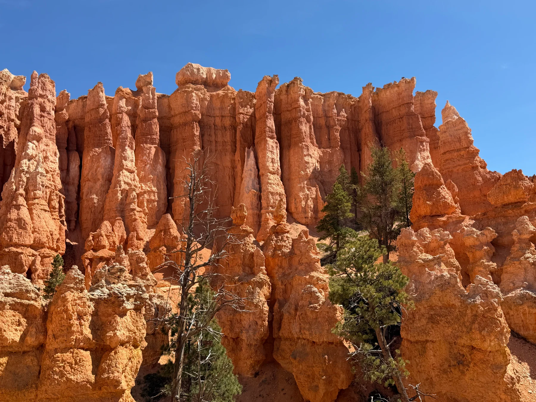
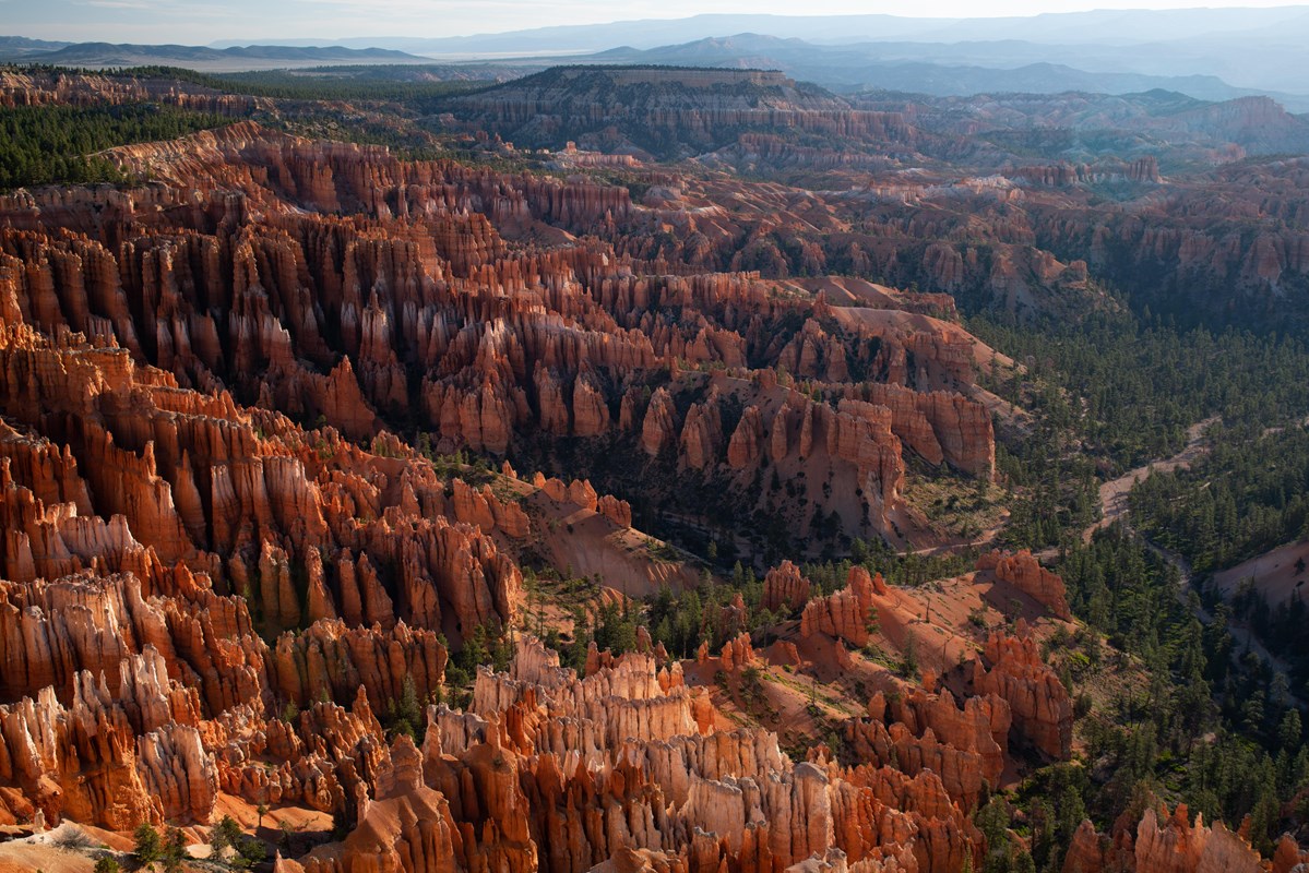
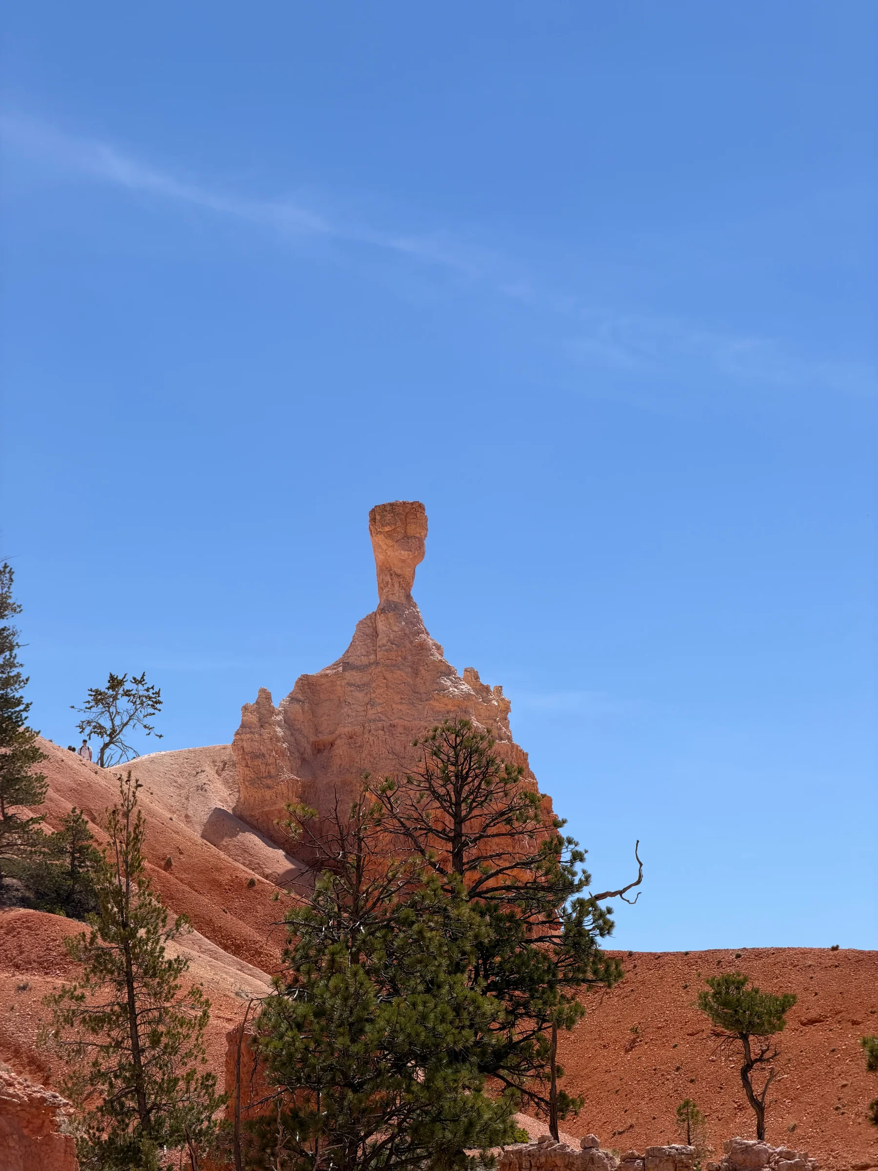
Even though these months are busy, May through October offer milder conditions for rim walks and exploring the hoodoos. September is our pick because the weather is comfortable and in-park stays are broadly in season. It is still busy, with average visits at 98% of the peak in June.
Confirm your room or campsite’s operating dates and reservation.
Compare Bryce Canyon by month.
Compare Bryce Canyon crowds, rim weather, road access and in-park stays for every month. Access covers the main scenic drive and seasonal spur roads. Stays describes seasonal choice, not vacancies.
The lowest average visits, with snow and cold nights. Plan for winter trail and road conditions.Read the January guide →
January crowds
34,058 average January visits in 2021–2025.
Monthly recreation visits
47 annual records · 1979–2025
Scroll the chart to see all years →
Hover, focus or tap a bar to see its year and value.
NPS recreation visits are visits, not unique visitors or a measure of how busy an individual trail feels. Counts can reflect closures, disruptions and changes in counting methods.
The HQRS station is near the visitor center at about 7,890 feet. The southern viewpoints are higher and can be colder and snowier. These are climate averages, not your trip forecast.
January weather through the years at Bryce Canyon NP HQRS.
Average daily high and low (°F)
41 complete high-temperature records · 35 complete low-temperature records
■ High■ Low
Scroll the chart to see all years →
Hover, focus or tap a bar to see its year and value.
Monthly precipitation (inches)
31 complete rain records
Scroll the chart to see all years →
Hover, focus or tap a bar to see its year and value.
Bryce Canyon NP HQRS observations, not a park-wide average or forecast. Each temperature value is the mean of daily highs or lows; rain is the monthly total. Each metric requires every calendar day to be present and pass NOAA quality checks. Incomplete months are gaps. Presumed-zero and lagged measurements are excluded; trace rain counts as zero measurable rain. No interpolation or station substitution. Completed years only. These observations are separate from the 1991–2020 normals.
All in-park lodge room types and both developed campgrounds. Seasons are planning guidance, not vacancies. Lodge units share one area marker; winter room schedules need direct confirmation. Backcountry sites are separate. These are normal seasonal schedules, not room or campsite availability.
Lodge complex
Main Lodge and suites
Closed
Outside the usual spring-to-fall season. Check the operator for any winter offering.
Sunrise Motel
Closed
Outside the usual spring-to-fall season. Check the operator for any winter offering.
Sunset Motel
Unverified
NPS mentions possible winter rooms, but the operator does not publish a dependable winter season. Confirm directly.
Western cabins
Closed
Outside the usual spring-to-fall season. Check the operator for any winter offering.
Hover, focus or tap a bar to see its year and value.
NPS recreation visits are visits, not unique visitors or a measure of how busy an individual trail feels. Counts can reflect closures, disruptions and changes in counting methods.
The HQRS station is near the visitor center at about 7,890 feet. The southern viewpoints are higher and can be colder and snowier. These are climate averages, not your trip forecast.
February weather through the years at Bryce Canyon NP HQRS.
Average daily high and low (°F)
46 complete high-temperature records · 36 complete low-temperature records
■ High■ Low
Scroll the chart to see all years →
Hover, focus or tap a bar to see its year and value.
Monthly precipitation (inches)
33 complete rain records
Scroll the chart to see all years →
Hover, focus or tap a bar to see its year and value.
Bryce Canyon NP HQRS observations, not a park-wide average or forecast. Each temperature value is the mean of daily highs or lows; rain is the monthly total. Each metric requires every calendar day to be present and pass NOAA quality checks. Incomplete months are gaps. Presumed-zero and lagged measurements are excluded; trace rain counts as zero measurable rain. No interpolation or station substitution. Completed years only. These observations are separate from the 1991–2020 normals.
All in-park lodge room types and both developed campgrounds. Seasons are planning guidance, not vacancies. Lodge units share one area marker; winter room schedules need direct confirmation. Backcountry sites are separate. These are normal seasonal schedules, not room or campsite availability.
Lodge complex
Main Lodge and suites
Closed
Outside the usual spring-to-fall season. Check the operator for any winter offering.
Sunrise Motel
Closed
Outside the usual spring-to-fall season. Check the operator for any winter offering.
Sunset Motel
Unverified
NPS mentions possible winter rooms, but the operator does not publish a dependable winter season. Confirm directly.
Western cabins
Closed
Outside the usual spring-to-fall season. Check the operator for any winter offering.
Heavy spring snow is still possible. Lodge room types and campground seasons begin at different times.Read the March guide →
March crowds
97,703 average March visits in 2021–2025.
Monthly recreation visits
47 annual records · 1979–2025
Scroll the chart to see all years →
Hover, focus or tap a bar to see its year and value.
NPS recreation visits are visits, not unique visitors or a measure of how busy an individual trail feels. Counts can reflect closures, disruptions and changes in counting methods.
The HQRS station is near the visitor center at about 7,890 feet. The southern viewpoints are higher and can be colder and snowier. These are climate averages, not your trip forecast.
March weather through the years at Bryce Canyon NP HQRS.
Average daily high and low (°F)
42 complete high-temperature records · 38 complete low-temperature records
■ High■ Low
Scroll the chart to see all years →
Hover, focus or tap a bar to see its year and value.
Monthly precipitation (inches)
34 complete rain records
Scroll the chart to see all years →
Hover, focus or tap a bar to see its year and value.
Bryce Canyon NP HQRS observations, not a park-wide average or forecast. Each temperature value is the mean of daily highs or lows; rain is the monthly total. Each metric requires every calendar day to be present and pass NOAA quality checks. Incomplete months are gaps. Presumed-zero and lagged measurements are excluded; trace rain counts as zero measurable rain. No interpolation or station substitution. Completed years only. These observations are separate from the 1991–2020 normals.
All in-park lodge room types and both developed campgrounds. Seasons are planning guidance, not vacancies. Lodge units share one area marker; winter room schedules need direct confirmation. Backcountry sites are separate. These are normal seasonal schedules, not room or campsite availability.
Lodge complex
Main Lodge and suites
Part month
The published season begins or ends around this part of the year; dates vary by room type.
Sunrise Motel
Part month
The published season begins or ends around this part of the year; dates vary by room type.
Sunset Motel
Part month
The published season begins or ends around this part of the year; dates vary by room type.
Western cabins
Closed
Outside the usual spring-to-fall season. Check the operator for any winter offering.
A transition month with cold nights and possible heavy snow. Check trails and seasonal opening dates.Read the April guide →
April crowds
215,140 average April visits in 2021–2025.
Monthly recreation visits
47 annual records · 1979–2025
Scroll the chart to see all years →
Hover, focus or tap a bar to see its year and value.
NPS recreation visits are visits, not unique visitors or a measure of how busy an individual trail feels. Counts can reflect closures, disruptions and changes in counting methods.
The HQRS station is near the visitor center at about 7,890 feet. The southern viewpoints are higher and can be colder and snowier. These are climate averages, not your trip forecast.
April weather through the years at Bryce Canyon NP HQRS.
Average daily high and low (°F)
46 complete high-temperature records · 42 complete low-temperature records
■ High■ Low
Scroll the chart to see all years →
Hover, focus or tap a bar to see its year and value.
Monthly precipitation (inches)
35 complete rain records
Scroll the chart to see all years →
Hover, focus or tap a bar to see its year and value.
Bryce Canyon NP HQRS observations, not a park-wide average or forecast. Each temperature value is the mean of daily highs or lows; rain is the monthly total. Each metric requires every calendar day to be present and pass NOAA quality checks. Incomplete months are gaps. Presumed-zero and lagged measurements are excluded; trace rain counts as zero measurable rain. No interpolation or station substitution. Completed years only. These observations are separate from the 1991–2020 normals.
All in-park lodge room types and both developed campgrounds. Seasons are planning guidance, not vacancies. Lodge units share one area marker; winter room schedules need direct confirmation. Backcountry sites are separate. These are normal seasonal schedules, not room or campsite availability.
Lodge complex
Main Lodge and suites
Open
Within the usual operating season. This is not room availability.
Sunrise Motel
Open
Within the usual operating season. This is not room availability.
Sunset Motel
Open
Within the usual operating season. This is not room availability.
Western cabins
Part month
The published season begins or ends around this part of the year; dates vary by room type.
Milder walking weather, with cold mornings and occasional late snow. Lodge and campground choice broadens.Read the May guide →
May crowds
297,892 average May visits in 2021–2025.
Monthly recreation visits
47 annual records · 1979–2025
Scroll the chart to see all years →
Hover, focus or tap a bar to see its year and value.
NPS recreation visits are visits, not unique visitors or a measure of how busy an individual trail feels. Counts can reflect closures, disruptions and changes in counting methods.
The HQRS station is near the visitor center at about 7,890 feet. The southern viewpoints are higher and can be colder and snowier. These are climate averages, not your trip forecast.
May weather through the years at Bryce Canyon NP HQRS.
Average daily high and low (°F)
42 complete high-temperature records · 39 complete low-temperature records
■ High■ Low
Scroll the chart to see all years →
Hover, focus or tap a bar to see its year and value.
Monthly precipitation (inches)
36 complete rain records
Scroll the chart to see all years →
Hover, focus or tap a bar to see its year and value.
Bryce Canyon NP HQRS observations, not a park-wide average or forecast. Each temperature value is the mean of daily highs or lows; rain is the monthly total. Each metric requires every calendar day to be present and pass NOAA quality checks. Incomplete months are gaps. Presumed-zero and lagged measurements are excluded; trace rain counts as zero measurable rain. No interpolation or station substitution. Completed years only. These observations are separate from the 1991–2020 normals.
All in-park lodge room types and both developed campgrounds. Seasons are planning guidance, not vacancies. Lodge units share one area marker; winter room schedules need direct confirmation. Backcountry sites are separate. These are normal seasonal schedules, not room or campsite availability.
Lodge complex
Main Lodge and suites
Open
Within the usual operating season. This is not room availability.
Sunrise Motel
Open
Within the usual operating season. This is not room availability.
Sunset Motel
Open
Within the usual operating season. This is not room availability.
Western cabins
Open
Within the usual operating season. This is not room availability.
Peak average visits, with comfortable days and relatively dry normals. Book the stay you want ahead.Read the June guide →
June crowds
330,635 average June visits in 2021–2025.
Monthly recreation visits
47 annual records · 1979–2025
Scroll the chart to see all years →
Hover, focus or tap a bar to see its year and value.
NPS recreation visits are visits, not unique visitors or a measure of how busy an individual trail feels. Counts can reflect closures, disruptions and changes in counting methods.
The HQRS station is near the visitor center at about 7,890 feet. The southern viewpoints are higher and can be colder and snowier. These are climate averages, not your trip forecast.
June weather through the years at Bryce Canyon NP HQRS.
Average daily high and low (°F)
48 complete high-temperature records · 46 complete low-temperature records
■ High■ Low
Scroll the chart to see all years →
Hover, focus or tap a bar to see its year and value.
Monthly precipitation (inches)
35 complete rain records
Scroll the chart to see all years →
Hover, focus or tap a bar to see its year and value.
Bryce Canyon NP HQRS observations, not a park-wide average or forecast. Each temperature value is the mean of daily highs or lows; rain is the monthly total. Each metric requires every calendar day to be present and pass NOAA quality checks. Incomplete months are gaps. Presumed-zero and lagged measurements are excluded; trace rain counts as zero measurable rain. No interpolation or station substitution. Completed years only. These observations are separate from the 1991–2020 normals.
All in-park lodge room types and both developed campgrounds. Seasons are planning guidance, not vacancies. Lodge units share one area marker; winter room schedules need direct confirmation. Backcountry sites are separate. These are normal seasonal schedules, not room or campsite availability.
Lodge complex
Main Lodge and suites
Open
Within the usual operating season. This is not room availability.
Sunrise Motel
Open
Within the usual operating season. This is not room availability.
Sunset Motel
Open
Within the usual operating season. This is not room availability.
Western cabins
Open
Within the usual operating season. This is not room availability.
The warmest normal month. Afternoon thunderstorms require flexible walking plans.Read the July guide →
July crowds
300,193 average July visits in 2021–2025.
Monthly recreation visits
47 annual records · 1979–2025
Scroll the chart to see all years →
Hover, focus or tap a bar to see its year and value.
NPS recreation visits are visits, not unique visitors or a measure of how busy an individual trail feels. Counts can reflect closures, disruptions and changes in counting methods.
The HQRS station is near the visitor center at about 7,890 feet. The southern viewpoints are higher and can be colder and snowier. These are climate averages, not your trip forecast.
July weather through the years at Bryce Canyon NP HQRS.
Average daily high and low (°F)
48 complete high-temperature records · 44 complete low-temperature records
■ High■ Low
Scroll the chart to see all years →
Hover, focus or tap a bar to see its year and value.
Monthly precipitation (inches)
35 complete rain records
Scroll the chart to see all years →
Hover, focus or tap a bar to see its year and value.
Bryce Canyon NP HQRS observations, not a park-wide average or forecast. Each temperature value is the mean of daily highs or lows; rain is the monthly total. Each metric requires every calendar day to be present and pass NOAA quality checks. Incomplete months are gaps. Presumed-zero and lagged measurements are excluded; trace rain counts as zero measurable rain. No interpolation or station substitution. Completed years only. These observations are separate from the 1991–2020 normals.
All in-park lodge room types and both developed campgrounds. Seasons are planning guidance, not vacancies. Lodge units share one area marker; winter room schedules need direct confirmation. Backcountry sites are separate. These are normal seasonal schedules, not room or campsite availability.
Lodge complex
Main Lodge and suites
Open
Within the usual operating season. This is not room availability.
Sunrise Motel
Open
Within the usual operating season. This is not room availability.
Sunset Motel
Open
Within the usual operating season. This is not room availability.
Western cabins
Open
Within the usual operating season. This is not room availability.
Comfortable high-elevation summer temperatures, with frequent afternoon thunderstorms.Read the August guide →
August crowds
268,214 average August visits in 2021–2025.
Monthly recreation visits
47 annual records · 1979–2025
Scroll the chart to see all years →
Hover, focus or tap a bar to see its year and value.
NPS recreation visits are visits, not unique visitors or a measure of how busy an individual trail feels. Counts can reflect closures, disruptions and changes in counting methods.
The HQRS station is near the visitor center at about 7,890 feet. The southern viewpoints are higher and can be colder and snowier. These are climate averages, not your trip forecast.
August weather through the years at Bryce Canyon NP HQRS.
Average daily high and low (°F)
51 complete high-temperature records · 49 complete low-temperature records
■ High■ Low
Scroll the chart to see all years →
Hover, focus or tap a bar to see its year and value.
Monthly precipitation (inches)
36 complete rain records
Scroll the chart to see all years →
Hover, focus or tap a bar to see its year and value.
Bryce Canyon NP HQRS observations, not a park-wide average or forecast. Each temperature value is the mean of daily highs or lows; rain is the monthly total. Each metric requires every calendar day to be present and pass NOAA quality checks. Incomplete months are gaps. Presumed-zero and lagged measurements are excluded; trace rain counts as zero measurable rain. No interpolation or station substitution. Completed years only. These observations are separate from the 1991–2020 normals.
All in-park lodge room types and both developed campgrounds. Seasons are planning guidance, not vacancies. Lodge units share one area marker; winter room schedules need direct confirmation. Backcountry sites are separate. These are normal seasonal schedules, not room or campsite availability.
Lodge complex
Main Lodge and suites
Open
Within the usual operating season. This is not room availability.
Sunrise Motel
Open
Within the usual operating season. This is not room availability.
Sunset Motel
Open
Within the usual operating season. This is not room availability.
Western cabins
Open
Within the usual operating season. This is not room availability.
Our weather pick, with broad seasonal access and stays. Average visits are nearly at the annual peak.Read the September guide →
September crowds
324,593 average September visits in 2021–2025.
Monthly recreation visits
47 annual records · 1979–2025
Scroll the chart to see all years →
Hover, focus or tap a bar to see its year and value.
NPS recreation visits are visits, not unique visitors or a measure of how busy an individual trail feels. Counts can reflect closures, disruptions and changes in counting methods.
The HQRS station is near the visitor center at about 7,890 feet. The southern viewpoints are higher and can be colder and snowier. These are climate averages, not your trip forecast.
September weather through the years at Bryce Canyon NP HQRS.
Average daily high and low (°F)
59 complete high-temperature records · 46 complete low-temperature records
■ High■ Low
Scroll the chart to see all years →
Hover, focus or tap a bar to see its year and value.
Monthly precipitation (inches)
36 complete rain records
Scroll the chart to see all years →
Hover, focus or tap a bar to see its year and value.
Bryce Canyon NP HQRS observations, not a park-wide average or forecast. Each temperature value is the mean of daily highs or lows; rain is the monthly total. Each metric requires every calendar day to be present and pass NOAA quality checks. Incomplete months are gaps. Presumed-zero and lagged measurements are excluded; trace rain counts as zero measurable rain. No interpolation or station substitution. Completed years only. These observations are separate from the 1991–2020 normals.
All in-park lodge room types and both developed campgrounds. Seasons are planning guidance, not vacancies. Lodge units share one area marker; winter room schedules need direct confirmation. Backcountry sites are separate. These are normal seasonal schedules, not room or campsite availability.
Lodge complex
Main Lodge and suites
Open
Within the usual operating season. This is not room availability.
Sunrise Motel
Open
Within the usual operating season. This is not room availability.
Sunset Motel
Open
Within the usual operating season. This is not room availability.
Western cabins
Open
Within the usual operating season. This is not room availability.
A cooler alternative with lower average visits. Snow can return and some stays close during the month.Read the October guide →
October crowds
235,422 average October visits in 2021–2025.
Monthly recreation visits
47 annual records · 1979–2025
Scroll the chart to see all years →
Hover, focus or tap a bar to see its year and value.
NPS recreation visits are visits, not unique visitors or a measure of how busy an individual trail feels. Counts can reflect closures, disruptions and changes in counting methods.
The HQRS station is near the visitor center at about 7,890 feet. The southern viewpoints are higher and can be colder and snowier. These are climate averages, not your trip forecast.
October weather through the years at Bryce Canyon NP HQRS.
Average daily high and low (°F)
49 complete high-temperature records · 41 complete low-temperature records
■ High■ Low
Scroll the chart to see all years →
Hover, focus or tap a bar to see its year and value.
Monthly precipitation (inches)
37 complete rain records
Scroll the chart to see all years →
Hover, focus or tap a bar to see its year and value.
Bryce Canyon NP HQRS observations, not a park-wide average or forecast. Each temperature value is the mean of daily highs or lows; rain is the monthly total. Each metric requires every calendar day to be present and pass NOAA quality checks. Incomplete months are gaps. Presumed-zero and lagged measurements are excluded; trace rain counts as zero measurable rain. No interpolation or station substitution. Completed years only. These observations are separate from the 1991–2020 normals.
All in-park lodge room types and both developed campgrounds. Seasons are planning guidance, not vacancies. Lodge units share one area marker; winter room schedules need direct confirmation. Backcountry sites are separate. These are normal seasonal schedules, not room or campsite availability.
Lodge complex
Main Lodge and suites
Open
Within the usual operating season. This is not room availability.
Sunrise Motel
Open
Within the usual operating season. This is not room availability.
Sunset Motel
Open
Within the usual operating season. This is not room availability.
Western cabins
Part month
The published season begins or ends around this part of the year; dates vary by room type.
Winter conditions become more likely. Expect reduced seasonal lodging and campground choice.Read the November guide →
November crowds
80,315 average November visits in 2021–2025.
Monthly recreation visits
47 annual records · 1979–2025
Scroll the chart to see all years →
Hover, focus or tap a bar to see its year and value.
NPS recreation visits are visits, not unique visitors or a measure of how busy an individual trail feels. Counts can reflect closures, disruptions and changes in counting methods.
The HQRS station is near the visitor center at about 7,890 feet. The southern viewpoints are higher and can be colder and snowier. These are climate averages, not your trip forecast.
November weather through the years at Bryce Canyon NP HQRS.
Average daily high and low (°F)
46 complete high-temperature records · 37 complete low-temperature records
■ High■ Low
Scroll the chart to see all years →
Hover, focus or tap a bar to see its year and value.
Monthly precipitation (inches)
34 complete rain records
Scroll the chart to see all years →
Hover, focus or tap a bar to see its year and value.
Bryce Canyon NP HQRS observations, not a park-wide average or forecast. Each temperature value is the mean of daily highs or lows; rain is the monthly total. Each metric requires every calendar day to be present and pass NOAA quality checks. Incomplete months are gaps. Presumed-zero and lagged measurements are excluded; trace rain counts as zero measurable rain. No interpolation or station substitution. Completed years only. These observations are separate from the 1991–2020 normals.
All in-park lodge room types and both developed campgrounds. Seasons are planning guidance, not vacancies. Lodge units share one area marker; winter room schedules need direct confirmation. Backcountry sites are separate. These are normal seasonal schedules, not room or campsite availability.
Lodge complex
Main Lodge and suites
Part month
The published season begins or ends around this part of the year; dates vary by room type.
Sunrise Motel
Part month
The published season begins or ends around this part of the year; dates vary by room type.
Sunset Motel
Part month
The published season begins or ends around this part of the year; dates vary by room type.
Western cabins
Closed
Outside the usual spring-to-fall season. Check the operator for any winter offering.
Cold and snow reshape the trip. North Campground has a year-round season; confirm any winter rooms directly.Read the December guide →
December crowds
55,431 average December visits in 2021–2025.
Monthly recreation visits
47 annual records · 1979–2025
Scroll the chart to see all years →
Hover, focus or tap a bar to see its year and value.
NPS recreation visits are visits, not unique visitors or a measure of how busy an individual trail feels. Counts can reflect closures, disruptions and changes in counting methods.
The HQRS station is near the visitor center at about 7,890 feet. The southern viewpoints are higher and can be colder and snowier. These are climate averages, not your trip forecast.
December weather through the years at Bryce Canyon NP HQRS.
Average daily high and low (°F)
45 complete high-temperature records · 38 complete low-temperature records
■ High■ Low
Scroll the chart to see all years →
Hover, focus or tap a bar to see its year and value.
Monthly precipitation (inches)
30 complete rain records
Scroll the chart to see all years →
Hover, focus or tap a bar to see its year and value.
Bryce Canyon NP HQRS observations, not a park-wide average or forecast. Each temperature value is the mean of daily highs or lows; rain is the monthly total. Each metric requires every calendar day to be present and pass NOAA quality checks. Incomplete months are gaps. Presumed-zero and lagged measurements are excluded; trace rain counts as zero measurable rain. No interpolation or station substitution. Completed years only. These observations are separate from the 1991–2020 normals.
All in-park lodge room types and both developed campgrounds. Seasons are planning guidance, not vacancies. Lodge units share one area marker; winter room schedules need direct confirmation. Backcountry sites are separate. These are normal seasonal schedules, not room or campsite availability.
Lodge complex
Main Lodge and suites
Closed
Outside the usual spring-to-fall season. Check the operator for any winter offering.
Sunrise Motel
Closed
Outside the usual spring-to-fall season. Check the operator for any winter offering.
Sunset Motel
Unverified
NPS mentions possible winter rooms, but the operator does not publish a dependable winter season. Confirm directly.
Western cabins
Closed
Outside the usual spring-to-fall season. Check the operator for any winter offering.
September is a weather pick, not a quiet month. Its average recreation visits are nearly as high as June’s. Thunderstorms remain possible; October offers lower average visits but colder nights and fewer seasonal stays.
Rain, snow, latest-year counts, and the weather station
The HQRS station is near the visitor center at about 7,890 feet. The southern viewpoints are higher and can be colder and snowier. These are climate averages, not your trip forecast.
Month
Visits in 2025
Rain
Snow
Jan
39,682
1.91″
19.8″
Feb
45,010
1.70″
18.1″
Mar
106,961
1.27″
13.2″
Apr
199,394
0.77″
5.9″
May
242,406
0.91″
1.5″
Jun
249,662
0.47″
0.2″
Jul
234,414
1.55″
0.0″
Aug
230,476
1.94″
0.0″
Sep
265,048
1.78″
0.0″
Oct
202,248
1.73″
3.0″
Nov
87,263
1.28″
9.7″
Dec
64,803
1.34″
15.3″
How these scores are computed (and why there is no combined "best month")
Crowds
Higher scores mean fewer visits compared with this park's busiest month. We use 2021–2025 monthly averages from NPS.
June is the peak, so it scores 0. A score of 50 means half as many visits as the peak month. These are recreation visits, not unique visitors or a measure of trail crowding.
Weather
Higher scores favor comfortable daytime temperatures, less rain and average lows above freezing. Inputs are 1991–2020 NOAA normals at Bryce Canyon NP HQRS, UT, not a forecast.
Daytime highs of 60–78°F earn the full comfort score. Rain above 1.5 inches per month lowers it. Scores are rounded and kept between 0 and 100.
Roads and lodging
These are normal operating patterns, not a score. Entrance hours and lodging seasons can be described, but they do not establish a percentage of the park that is accessible or how many rooms are available.
Bryce Canyon has one main vehicle entrance on UT-63. The scenic road continues south; Fairyland Point and Paria View are side roads with winter vehicle closures. The seasonal shuttle serves the amphitheater area.
Enter from UT-63. The entrance operates year-round. After snowstorms, the southern scenic drive can close beyond Mile 3 for plowing. Check conditions before driving to the southern viewpoints.
A seasonal side road, not an entrance. The spur closes to vehicles when snow requires plowing elsewhere. Winter foot travel is separate from vehicle access.
Choose the Bryce Canyon Lodge complex or one of two developed campgrounds. Lodge room types have different seasons. North camping is year-round; Sunset camping is seasonal. Confirm dates before booking.
Suites, two motel units and cabins. The main lodge, Sunrise Motel, Sunset Motel and Western cabins follow different spring-to-fall dates. Winter room guidance differs between NPS and the operator, so confirm directly instead of assuming a winter stay.
A year-round camping season. Fewer loops operate in winter. Check the campsite type, operating dates and reservation rules before committing to a trip.
Spring-to-fall camping. Snow affects the opening, and the season winds down in autumn. The month-by-month list treats opening and closing months as partial rather than promising a full month.
Stay near the UT-63 park approach. Compare hotels, cabins and camping in the county directory. Check each property’s operating dates, especially in winter.
September is our pick for rim walks, hoodoo hikes and the scenic drive. The rim station averages highs near 70°F and lows near 42°F, with broad seasonal lodging and camping choice. It is still busy; October has lower average visits but colder nights.
Is October a good time to visit Bryce Canyon?
Yes, with warm layers and flexible plans. Rim averages are about 58°F by day and 32°F at night. Snowstorms are possible and campground or lodge seasons can end during the month. Check NPS weather guidance and the dates of your chosen stay.
Is Bryce Canyon too hot in summer?
Its high elevation makes summer days milder than in many lower desert parks. July averages about 80°F at the rim station. Heat still matters on exposed hikes, and NPS warns of frequent afternoon thunderstorms in July and August.
When is Bryce Canyon least crowded?
January has the lowest average recreation visits in the 2021–2025 data. That means winter weather and fewer seasonal stays. October is an alternative with lower visits than September and less severe cold than midwinter. Park visits do not measure a particular trail queue.
Can you visit Bryce Canyon in winter?
Yes. The entrance operates year-round, but snow can temporarily interrupt the southern scenic drive. Fairyland Point and Paria View roads close to vehicles for the snow season, and icy trails may need traction. Read the NPS winter guide before choosing your route.
Where can you stay inside Bryce Canyon?
The Lodge at Bryce Canyon has suites, two motel units and cabins with different seasons. North Campground has a year-round season; Sunset Campground closes in winter. Review the monthly list above, then confirm lodge dates or campground dates. Seasonal availability is not a room or campsite vacancy.
Compare other parks
Compare seasonal patterns and trip options using the same NPS visit data.
Zion
The lower-elevation Utah neighbor, often paired with Bryce Canyon on one trip. Zion's narrow canyon and shuttle contrast with Bryce's open rim drive.
An independent guide using official data. Not affiliated with or endorsed by the National Park Service.
Crowds
2021–2025 monthly averages. NPS recreation visits, compared with the park’s own busiest month. Visits are not unique visitors or a count of people on a trail.
Weather
1991-2020 climate normals. NOAA’s Bryce Canyon NP HQRS station. These describe typical weather at the station, not every part of the park or a forecast.
Roads & lodging
Normal seasonal schedules. NPS guidance and official operator information. Confirm access, hours and availability before you travel.