Start at the visitor center
Use the paved approach, push-button front door and wheelchair-height information desk. Benches are inside and on the patio.
Arches National Park accessibility is strongest along the scenic drive, at the visitor center, and on short trail sections. Start with Lower Delicate Arch Viewpoint or the paved beginning of Balanced Rock. The full Delicate Arch hike and most longer trails have steep grades, steps, or sand. An all-terrain wheelchair loan requires someone to push it; it does not make every trail suitable.
Paved viewpoints and short trail sections offer different access from the full hikes. Compare the surface, steps and steepest grades before choosing a route.
| Area | Accessible route or view | Slopes, steps and other limits |
|---|---|---|
Arches Visitor Center | Push-button front door, accessible parking, a paved approach, wheelchair-accessible restrooms, and exhibits and a desk built to be used from a wheelchair. Benches inside and on the patio. The park film has open captions. | The visitor center lends an all-terrain chair that requires an assistant. NPS does not list a standard wheelchair rental; bring your own everyday chair. |
Courthouse Wash Rock Markings Panel Trail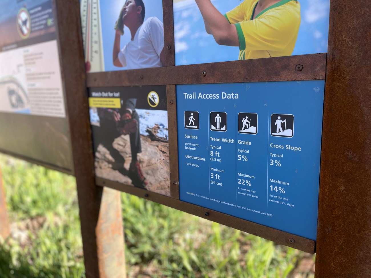 | 0.8 mile round trip on pavement and bedrock, with a typical grade of 5%. | Rock steps, a 22% maximum grade, and a tread as narrow as 3 feet. |
Park Avenue Trail | 1.8 miles round trip on bedrock and sand, with a typical grade of 5%. | Rock steps and ledges, a 52% maximum grade, and cross slopes up to 29%. |
Balanced Rock | The first section of the trail is paved and at least 6 feet wide, with a 7% maximum grade and 3% maximum cross slope. The nearby picnic area has paved sections. | Past the paved section, the 0.3-mile trail has rock steps and reaches 23%. |
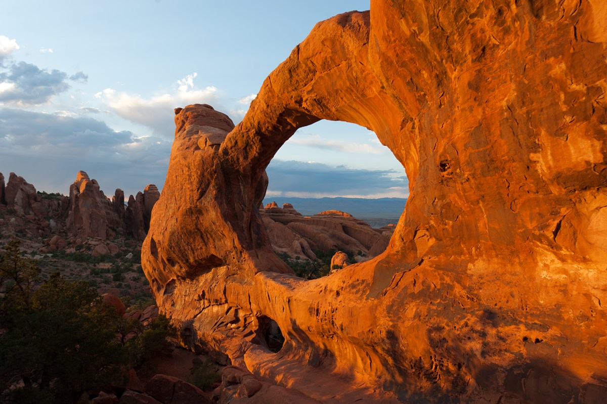
The Windows and Double ArchDirections to The Windows Section Parking LotThe Windows Section Parking Lot Use designated public parking. Check park access and vehicle restrictions before travel. 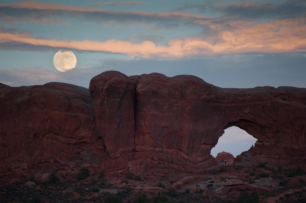 | The first 100 yards of the Windows Trail is barrier free, and the main trail is typically 10 feet wide. Double Arch Trail is 0.6 mile round trip on a hard surface with no obstructions and a typical grade of 5%. | After 100 yards the Windows Trail climbs uneven stone steps and reaches 38%; the primitive section reaches 79%. Double Arch turns sandy near the end and reaches 14%. |
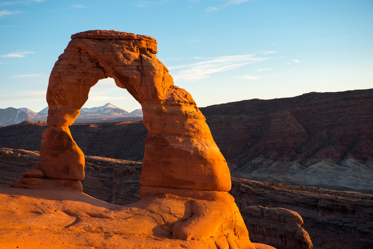
Delicate Arch viewpoints and trail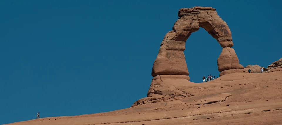 | The Lower Delicate Arch Viewpoint trail has a hard surface, no obstructions, a 12-foot minimum width, and grades of 8% or less. On the Delicate Arch Trail, the first section to a historic cabin and pictograph panel is hard-surfaced at less than 8%. | The Upper Viewpoint Trail has rock steps and stairs and reaches 41%. The full Delicate Arch Trail is 3.2 miles round trip with a steep climb, a ledge with a drop-off, and grades up to 80%. |
Devils GardenDirections to Devils Garden Parking LotDevils Garden Parking Lot Use designated public parking. Check park access and vehicle restrictions before travel.  | Landscape Arch Trail starts on pavement and bedrock, typically 10 feet wide with a typical grade of 6%. The picnic area has paved sections, and every campground toilet is accessible. | Rock steps at the end of the Landscape Arch Trail and a 30% maximum grade. Beyond Landscape Arch the trail has steep climbs, ledges, and drop-offs. |
| Sand Dune Arch and Skyline Arch | Both are short, 0.4 mile round trip, with a typical grade of 5%. | Sand Dune Arch has deep sand and a boulder in a passage as narrow as 19 inches, with a 50% maximum grade. Skyline Arch has rock steps and reaches 51%. |
These are NPS maximum grades, not typical effort or an accessibility rating. The paved beginning of Balanced Rock differs from the full loop.
| Route or section | Grade stated by the official source |
|---|---|
| Balanced Rock, paved first section | 7% |
| Lower Delicate Arch Viewpoint | 8%8% or less |
| Double Arch Trail | 14% |
| Courthouse Wash Panel Trail | 22% |
| Balanced Rock Trail, full | 23% |
| Landscape Arch Trail | 30% |
| Main Windows Trail | 38% |
| Upper Delicate Arch Viewpoint | 41% |
| Sand Dune Arch Trail | 50% |
| Skyline Arch Trail | 51% |
| Park Avenue Trail | 52% |
| Delicate Arch Trail | 80% |
Maximum grade on each trail or trail section, from the NPS physical and mobility accessibility page. NPS reports how much of every trail exceeds 8% grade, so the dashed line marks that 8%. It is the park's own measure, not an ADA standard. The four longest Devils Garden and Tower Arch routes are left off.
The visitor center has a paved approach and a push-button door. NPS lists all park toilets as wheelchair accessible, but campground roads can still need assistance.
Use the paved approach, push-button front door and wheelchair-height information desk. Benches are inside and on the patio.
The campground road has steep slopes, speed bumps and drainage ditches. Accessible toilets do not make every approach easy.
The Arches Visitor Center is the best first stop. The front door opens with a push button, the approach is paved, and there's accessible parking. All restrooms are wheelchair accessible, and the exhibits and information desk are built to be used from a wheelchair. Benches sit inside the front of the building and out on the patio. Out in the park, NPS says every toilet is accessible to wheelchairs, and the picnic areas near Balanced Rock, Panorama Point, and Devils Garden have paved sections (NPS physical and mobility accessibility page).
The visitor center lends an all-terrain chair that needs an assistant. Bring your own everyday chair and check which routes the loan chair may use.
Ask at the visitor center. The chair is first-come, first-served, needs an assistant and must return before closing the same day.
NPS recommends Lower Delicate Arch Viewpoint, Landscape Arch, Double Arch and Skyline Arch for the loan chair. Other routes have restrictions or require more help.
Bring your own everyday chair. Arches Visitor Center lends a non-motorized all-terrain wheelchair, first-come, first-served, with no reservations. It requires an assistant to push it and must return before closing on the same day. Both user and assistant sign a waiver; one shows ID and proof of insurance. The maximum rider weight is 250 lbs and maximum height is 6 feet. NPS recommends Landscape Arch, Double Arch, Skyline Arch and Lower Delicate Arch Viewpoint for the loan chair. Sand Dune Arch, Broken Arch Loop and the Devils Garden Primitive Loop are prohibited. The source puts Tower Arch on both the prohibited and other-trails lists, so confirm with a ranger before considering it. NPS all-terrain wheelchair rules Only a few trails have paved sections. NPS calls others barrier free, but says they may have minor obstacles, steeper grades, or washouts and may need assistance, and that rain and snow can leave ruts.
U.S. citizens and permanent residents with permanent disabilities qualify for the Interagency Access Pass, which NPS says gives free or discounted admission at over 2,000 federal recreation sites. Our Arches fees page has the rest.
Park entry, camping and guided-hike requirements are separate from equipment access. Check our Arches reservations guide and the official booking pages before traveling.
Many arches and rock formations can be seen from the paved scenic road. A roadside view can be the whole outing when a trail is too steep.
NPS says you can explore much of Arches and see many famous arches and rock formations from the paved scenic road. For many visitors, that's the whole plan. Wolfe Ranch, where the Delicate Arch Trail starts, is 13 miles from the entrance, and Devils Garden sits at the north end, 18 miles in, per the NPS parking data. Stop at Balanced Rock for the paved first stretch of trail and a picnic area with paved sections. The bookstore at the visitor center sells or rents an audio tour of the scenic road.
The visitor center has tactile exhibits and audio resources. Ask the park about communication support before choosing a ranger program.
For visitors who are Deaf or have hearing loss, the park film, "Windows in Time," has open captions, and so do the video exhibits. Assistive listening devices, with headphones or a neck loop for hearing aids with t-coils, work with every video in the visitor center. You can request an American Sign Language interpreter for in-person ranger programs, and NPS suggests asking at least 7 days ahead (NPS hearing loss page).
For blind and low-vision visitors, the visitor center exhibits include audio recordings, tactile models and maps, and rock samples. The official park brochure comes in large print and braille at visitor centers, as a Braille Ready Format download, and as an audio version on CD or online. NPS is clear that there are no recorded descriptions of the exhibits or roadside waysides.
Service animals are welcome everywhere in Arches. A vest isn't required, but NPS says it helps head off "dog on trail" complaints, and trailheads have no waste bags, so bring your own. The bigger risk is heat. NPS recommends you not leave a service animal in the car at all when it's over 68 degrees outside, even with the windows cracked, and water is only available at the visitor center and Devils Garden (NPS accessibility page).
Devils Garden has two accessible campsites with different booking arrangements. The tent pads and campground road need a separate access check.
Devils Garden is the only campground in Arches, and two of its sites are accessible. Site 4H is held for people with disabilities and is first-come, first-served. Site 7 can be reserved up to six months in advance. At both, the tent pad is dirt but the area around the picnic table, grill, and fire ring is paved, with an accessible bathroom nearby. Every toilet in the campground is accessible. Getting around is harder: there are no paths through the campground, only the paved road, which has steep slopes, speed bumps, and drainage ditches, so NPS says wheelchairs may need help. The amphitheater has its own parking area and a paved sidewalk lined with small red lights, but the seating area is gravel with benches. Booking details are on our Arches camping page. The NPS accessibility pages say nothing about lodging.
Choose a short route before adding another stop. Heat, exposed rock and winter ice can make the same trail much harder.
NPS assessed every trail's grade, surface, and width, and it warns that conditions may have changed since. Rockfall, gullies, and potholes can show up in hard-surfaced sections. Use the numbers above to pick a turnaround point before you start. The Windows and Delicate Arch trails both have a gentle first section, so you can go that far and still see the arches.
Rangers offer programs spring through fall. Evening programs are at the Devils Garden Campground amphitheater, and guided walks at the Windows run up to a mile, barrier free for the first 100 yards before the stone steps.
After snow, NPS says popular trails like Delicate Arch and Devils Garden quickly get slippery with packed snow and ice (NPS winter page). Summer heat is the other limit, and our Arches with kids page covers heat and water. The best time to visit Arches page shows how busy each month gets.
Quick answers to the practical questions below.
Too strenuous for most visitors with limited mobility. NPS measures the Delicate Arch Trail at 3.2 miles round trip on hard ground and bedrock, with a steep climb, rock steps, and a ledge with a drop-off. Its grade reaches 80%, and 46% of the trail is steeper than 8%. For a view without the climb, the Lower Delicate Arch Viewpoint trail has a hard surface, no obstructions, and grades of 8% or less.
It can be, mostly from the car. NPS makes no age-specific statement, but much of the park can be seen from the paved scenic road, every toilet in the park is wheelchair accessible, and short hard-surfaced starts include Balanced Rock's paved section (7% maximum grade) and the Lower Delicate Arch Viewpoint (8% or less). Most longer trails have rock steps and steep grades.
No. NPS says ranger-led Fiery Furnace hikes are physically demanding: you walk and climb on uneven ground, along narrow ledges above drop-offs and in loose sand, jump across gaps, and in places hold yourself up by pushing against the sandstone walls with your hands and feet. Reservations are required.
An independent guide using official data. Not affiliated with or endorsed by the National Park Service.
Trail lengths, surfaces, obstructions, grades and cross slopes, the visitor center, toilets, picnic areas, campsites 4H and 7, the campground road and amphitheater, ranger programs, and the Fiery Furnace hike description come from the NPS physical and mobility accessibility page; blind and low-vision services, service animal rules, the 68-degree car warning, and the Access Pass from the NPS Arches accessibility page; captions, assistive listening, and interpreter requests from the NPS hearing loss page.
Wolfe Ranch and Devils Garden distances from NPS parking lot data (the NPS developer API); winter ice from the NPS winter page; the only-campground fact from the NPS camping page and the six-month booking window from NPS campground data (the NPS developer API).
The 8% chart line is the threshold NPS uses in its own trail figures, not an ADA standard. Turnaround advice is our own.
The all-terrain wheelchair loan, assistant and waiver requirements, rider limits and trail restrictions come from the NPS physical and mobility accessibility page. The Tower Arch lists conflict on that page, so visitors should confirm with a ranger.
Operational source check: September 11, 2026. Design and emphasized source review: 2026-10-23. A design review does not refresh every underlying record.