Shenandoah fall colors.

Shenandoah fall colors are usually at their most brilliant around the second or third week of October, according to NPS history. Treat that as a starting point, not a promised peak. Color starts high and moves downhill, and the broader fall season runs from late September through November. October is the park's busiest month, averaging 70% more visits than July. Choose a weekday, then use the park's fall reports and webcams to pick your stretch of Skyline Drive.

National Sites Guide

Share this page

Cite this page

Copy a citation

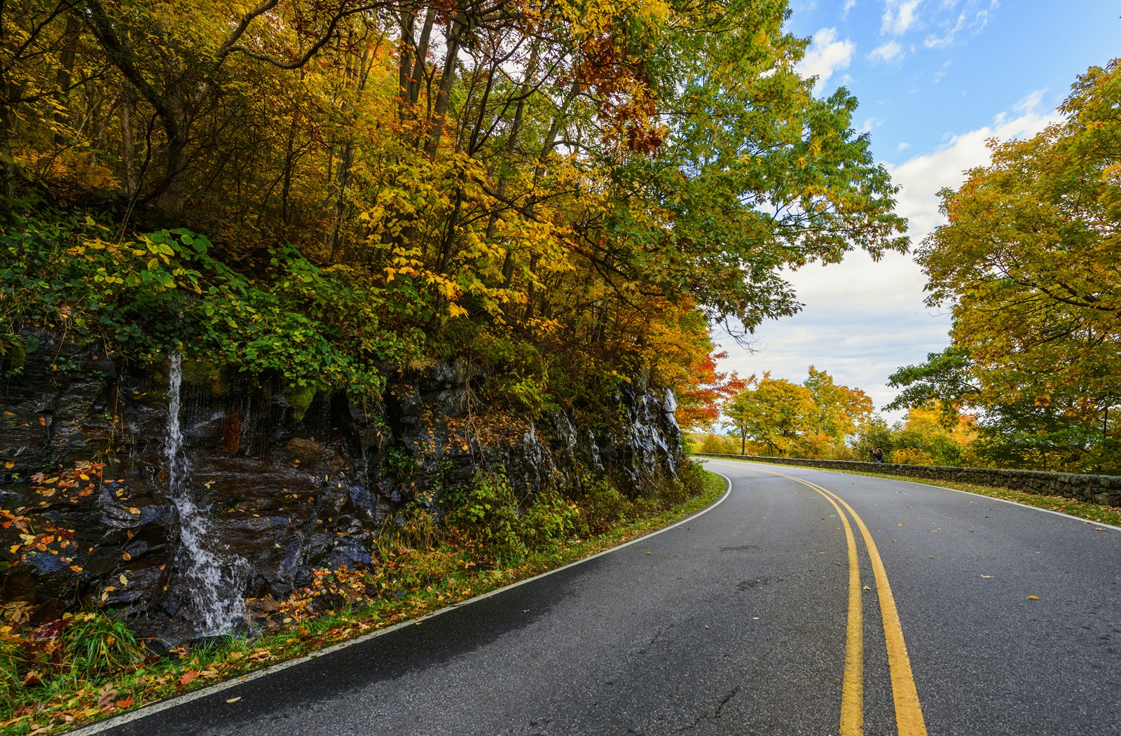
Skyline Drive curves past a wet rock face beneath yellow and green autumn leaves.
Skyline Drive in autumn.NPS Photo / Neal Lewis
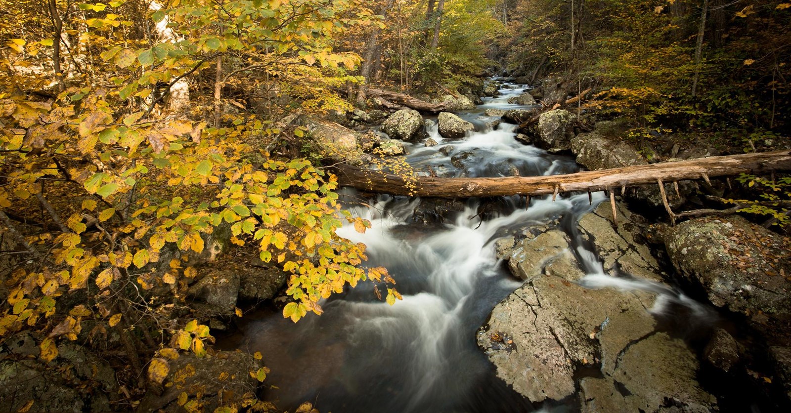
Water flows between rocks and a fallen log beneath yellow autumn leaves in Whiteoak Canyon.
Autumn in Whiteoak Canyon.NPS Photo / Brett Raeburn

Conditions

NPS alerts last checked

Alert list last changed

Check before you go

When to see fall colors

NPS history points to the second or third week of October for brilliant color. Elevation and weather keep any single peak date uncertain. Higher elevations change first. Color then moves downhill.

Late September

Season starts

November

Color can linger

Some years, well into November.

See fall colors by car

Follow Skyline Drive and choose stops near one entrance. Match map numbers to the photos.

Shenandoah fall-color places Skyline Drive, its four entrances and four places in the central district. Numbers match the archive photos below. Pins mark features and approaches, not camera positions. Road geometry, park boundary and numbered places: NPS. Entrance locations: © OpenStreetMap contributors. State outline: U.S. Census. Locations, not current access or leaf conditions. Front Royal Thornton Gap Marys Rock Tunnel1 Stony Man Trailhead2 Big Meadows3 Naked Creek Overlook4 Swift Run Gap Rockfish GapN
105 miles · 35 mph in most places · Allow 3–4 hours driving, plus stops and fall traffic.Skyline Drive, its four entrances and four places in the central district. Numbers match the archive photos in the key. Pins mark features and approaches, not camera positions. Road geometry, park boundary and numbered places: NPS. Entrance locations: © OpenStreetMap contributors. State outline: U.S. Census. Locations, not current access or leaf conditions.
Autumn trees and Skyline Drive seen through the dark arch of Marys Rock Tunnel.
1Marys Rock TunnelRoute landmark. Archive photo: November 4, 2024. The pin marks the tunnel, not the photographer. Enjoy the view from a safe stopping place.NPS Photo
Mostly bare wooded ridges and a winding section of Skyline Drive seen from Stony Man in late autumn.
2Stony Man TrailheadSummit view, November 4, 2024. The pin marks the trailhead at mile 41.7, not the summit. A 1.6-mile round trip reaches the view.
NPS Photo
Golden and rust-colored grasses surround a partly bare tree at Big Meadows beneath blue sky.
3Big MeadowsMeadow view, November 1, 2024. The pin marks the meadow area, not the lodge, campground or photographed tree.NPS Photo | L. Ellis
Yellow, orange and red trees fill the foreground below distant ridges at Naked Creek Overlook.
4Naked Creek OverlookOverlook view, October 13, 2024. The pin marks the named overlook, not the distant ridges.
NPS Photo | L. Ellis
  • Skyline Drive · NPS road geometry
  • Numbered feature and approach locations
  • Four vehicle entrances
  • National park boundary
  • State outline

See fall colors on foot

Choose a summit view, a forest circuit or a rocky viewpoint in the south.

A · Stony Man trail-network detail NPS trail network, not a complete route. Letter marks the mapped trail start. South Fork Dry RunSkyline Drive Stony Man Trail Stony Man Summit Trail Appalachian National Scenic Trail Stony Man trail startASouth Fork Dry RunN
NPS trail network, not a complete route. Letter marks the mapped trail start. Trail data: NPS / APPA.

AStony Man

1.6-mile round trip · Skyline Drive mile 41.7

A summit view over the Shenandoah Valley and surrounding mountains.

No pets. Service animals welcome. Does not meet ADA accessibility guidelines.

  • A · mapped trail network
  • A · trail start
  • Skyline Drive
  • National park area
  • Named rivers and streams (USGS NHD)
B · Limberlost trail-network detail NPS trail network, not a complete route. Letter marks the mapped trail start. Robinson RiverRobinson RiverRobinson RiverRobinson RiverEast Hawksbill CreekEast Hawksbill CreekEast Hawksbill CreekSkyline Drive Limberlost Accessible Trail Limberlost trail startBRobinson RiverN
NPS trail network, not a complete route. Letter marks the mapped trail start. Trail data: NPS.

BLimberlost

1.3-mile circuit · Skyline Drive mile 43

A forest circuit, primarily on crushed greenstone.

No pets. Service animals welcome. NPS calls it fully accessible. Maximum running slope: 10.3%. Read the detailed measurements for your needs.

  • B · mapped trail network
  • B · trail start
  • Skyline Drive
  • National park area
  • Named rivers and streams (USGS NHD)
C · Blackrock Summit trail-network detail NPS trail network, not a complete route. Letter marks the mapped trail start. Jones RunJones RunPaine RunSkyline Drive Appalachian National Scenic Trail Appalachian National Scenic Trail Trayfoot Mountain Trail Trayfoot Mountain Trail/Blackrock Hut Road AT Access-Blackrock Area Parking Blackrock Summit trail startCJones RunPaine RunN
NPS trail network, not a complete route. Letter marks the mapped trail start. Trail data: NPS / APPA.

CBlackrock Summit

1-mile circuit · Skyline Drive mile 84.4

A viewpoint on a rocky talus slope in the southern district.

Pets on a leash no longer than 6 feet. Does not meet ADA accessibility guidelines.

  • C · mapped trail network
  • C · trail start
  • Skyline Drive
  • National park area
  • Named rivers and streams (USGS NHD)

Shenandoah crowds by month

October has the most park visits, averaging 70% more than July. The fall months are highlighted below; monthly totals cannot predict a particular day’s traffic.

Fall months highlightedLate September through November
LowestLowModerateHighPeakAverage month: 133,666

Shenandoah fall colors questions

Quick answers for timing your trip and driving the ridge.

When is peak fall color in Shenandoah?

NPS history places the most brilliant color around the second or third week of October. Its fall guidance also says an exact peak cannot be predicted. Use that historical window to start planning, then check the park’s fall reports and webcams.

Is Skyline Drive crowded in October?

October is Shenandoah’s busiest month, averaging 70% more park visits than July. NPS recommends weekdays for a better chance of quieter trails and parking. Monthly counts do not measure road queues or guarantee a quiet weekday.

How long is Skyline Drive?

Skyline Drive runs 105 miles along the Blue Ridge. The speed limit is 35 mph in most places. NPS estimates about three hours on a clear day, while its FAQ says most people need three to four hours simply driving. Allow more for stops and fall traffic.

When do the leaves change in Shenandoah?

The broad fall season runs from late September through November. Higher-elevation trees generally change first, and color moves downhill. Use NPS fall reports and linked webcams to choose an area before travel.

How we built this page.

An independent guide using official data. Not affiliated with or endorsed by the National Park Service.

Fall timing
A typical season, not a forecast. Official park guidance explains the seasonal window and local variation. The map photographs show their subjects, not today’s leaf conditions.
Crowd context
2021–2025 monthly averages. NPS recreation visits count park visits, not unique visitors, foliage viewers, parking spaces or weekend traffic.
Trip planning
Official road and trail guidance. Check current conditions and operating calendars before travel. Monthly comparisons include all of September even when the fall window starts late in the month.