Florida map with place names
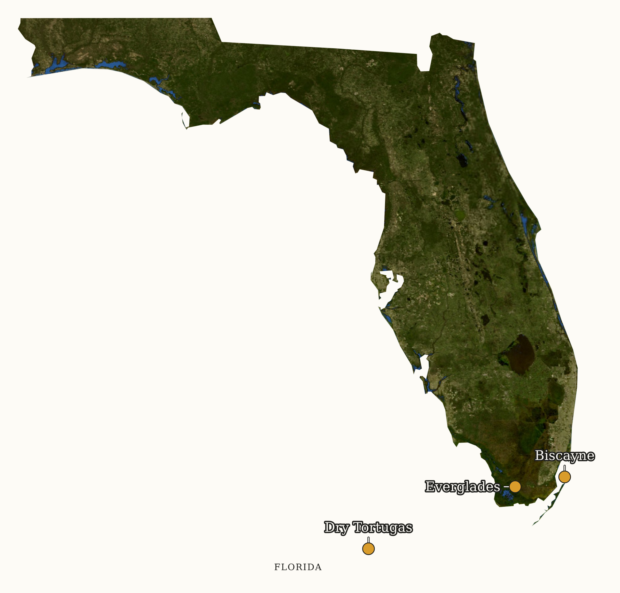
Customize or download the Florida map. Change the names, pins and background, or download a ready-made PNG or SVG.
NPS source records in Florida.
Florida has 10 records in our combined NPS metadata and visitor-statistics registry: 3 National Parks · 2 National Seashores · 2 National Monuments · 1 National Preserve · 1 National Memorial · 1 Ecological & Historic Preserve. This is a source-record count, not the Park Service's official system-unit census. Combined 5-year-average annual visits: 15,484,590 (multi-state units count their full visits in every state they touch, see methodology). The most-visited record is Gulf Islands National Seashore at about 6.96M annual visits.
Map of the broader NPS source-record directory
Marker positions are each unit's official NPS coordinates. State outline: U.S. Census cartographic boundary (public domain). Independent site, not affiliated with the National Park Service.
| Unit | Designation | 5-yr avg visits | Busiest month |
|---|---|---|---|
| Gulf Islands National Seashore | National SeashoreGUIS | 6,959,985 | July |
| Big Cypress National Preserve | National PreserveBICY | 2,358,594 | March |
| Canaveral National Seashore | National SeashoreCANA | 2,148,049 | March |
| Timucuan Ecological & Historic Preserve | Ecological & Historic PreserveTIMU | 1,020,812 | July |
| Everglades National Park | National ParkEVER | 885,539 | February |
| Fort Matanzas National Monument | National MonumentFOMA | 661,149 | July |
| Biscayne National Park | National ParkBISC | 595,340 | May |
| Castillo de San Marcos National Monument | National MonumentCASA | 589,612 | March |
| De Soto National Memorial | National MemorialDESO | 181,346 | March |
| Dry Tortugas National Park | National ParkDRTO | 84,164 | May |
Methodology
Rows come from our combined NPS metadata and Visitor Use Statistics registry, not the Park Service's official census of 433 managed system units. Per-record visit counts come from the official NPS Visitor Use Statistics Data Package, 2025; the "5-year average visits" column is the mean of 2021-2025 Recreation Visits. Multi-state records are listed under every state they touch, and their full visit total appears in each state. Official National Park counts use the central 63-park classification rather than the source designation label alone. Independent site, not affiliated with the National Park Service.
Independent site. Not affiliated with or endorsed by the National Park Service. Data comes from the official NPS Visitor Use Statistics Data Package, 2025; editorial analysis is ours. The NPS Arrowhead and other NPS marks are not used.